

Telangana - Geography
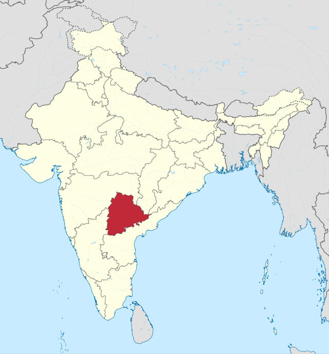
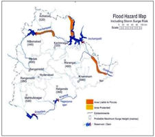
 Telangana is situated on the Deccan Plateau, in the central stretch of the eastern seaboard of the Indian Peninsula. It covers 114,840 square kilometers (44,340sq mi). The region is drained by two major rivers, with about 79% of the Godavari River catchment area and about 69% of the Krishna River catchment area, but most of the land is arid. Telangana is also drained by several minor rivers such as the Bhima, the Manjira and the Musi.
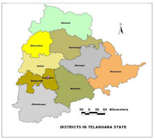
The Geographical area of the Telangana State for the year 2014-15 is 1,12,077 sq. kms., and stood at 12th position in India. The total geographical area of the State is 112.08 lakh hectares, of which the area under forest cover is 25.40 lakh hectares, constitute 22.66% of the land. About 39.05% area is under cultivation (43.77 lakh hectares), 12.50% is current fallow lands (14.01 lakh hectares), 7.90% of land is put to non-agricultural uses (8.85 lakh hectares), 5.42% is barren and uncultivable (6.07 lakh hects.) and 7.18% falls under other fallows (8.05 lakh hects.). The remaining 5.29% is under culturable waste, permanent pastures and other grazing lands, and land under miscellaneous tree crops and groves are not included in the net area sown (5.93 lakh hectares).
As per the Agricultural Census, 2010-11, the number of holdings in the State accounted to 55.54 lakh and the area held by these holdings was 61.97 lakh hectares. The average size of the holdings in the State is 1.12 hectares, which is highly uneconomical to operate. In the State, 62.0 percent of the holdings are marginal (less than 1 hectare) and the percentage of small holdings (1 to 2 hectares) is 23.9%. Thus, marginal and small holdings constitute about 85.9% of total agricultural holdings in the State, making agriculture a subsistence source of livelihood for majority of the population.
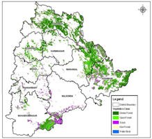
The Central Deccan Plateau dry deciduous forests eco-region covers much of the State, including Hyderabad. The characteristic vegetation is woodlands of Hardwickiabinata and Albiziaamara. Over 80% of the original forest cover has been cleared for agriculture, timber harvesting, or cattle grazing, but large blocks of forest can be found in Nagarjuna sagar-Srisailam Tiger Reserve and elsewhere. The more humid Eastern Highlands moist deciduous forests cover the Eastern Ghats in the eastern part of the state.
Forests constitute one of the major natural resource of the State. The forest area is the area recorded as forests by the Government as per revenue records. The State has 29,242 Sq. Kms as forest area including social forestry, which amounts to 25.46% of State area. Out of 29,242 Sq.kms, Reserved Forest area is 21,024 Sq.Kms, Protected forest forms 7468 Sq.Kms and the rest of 750 Sq.Kms are unclassified.
Over 20% of the coal deposits in the country is in Telangana region. Singareni Collieries excavate Coal and used it for industrial purposes and for thermal power stations. The coal supplied from this region, and the power produced is supplied to entire south India.
Telangana is also rich in limestone deposits that cater to cement factories. Telangana has other mineral resources like bauxite and mica. Various colors of Limestone Slabs from Tandur, (Rangareddy District), Betamcharla (Kurnool District), Tadipatri (Ananthapur District), Macherla (Guntur District), Mudimanikyam (Nalgonda District) are well known for flooring and paneling purposes within the country and are also being exported to many countries. Slate and Phyllites in various shades of colors from Prakasam, Guntur and Nalgonda Districts are used as decorative stones and are being exported to various countries.


|
NEWSLETTER
|
| Join the GlobalSecurity.org mailing list |
|
|
|