

New Orleans
| Satellite Imagery of New Orleans | |
| 2005 Hurricane Katrina | |
|---|---|
| !!! Please do not hotlink the images !!! | |
Hurricane Katrina
|
New Orleans Flooding Images |
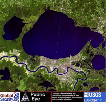
Comparative Landsat satellite imagery of the Greater New Orleans Area pre- and post-Hurricane Katrina [Click on image for larger version] |

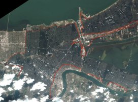
Comparative ASTER satellite imagery of New Orleans pre- and post-Hurricane Katrina [Click on image for larger version] |
Satellite imagery of New Orleans denoting the flooded areas. [Source: DigitalGlobe] |
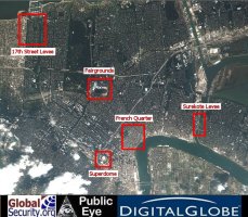
Satellite imagery showing the location of two levees that have failed in New Orleans, LA, following Hurricane Katrina. |
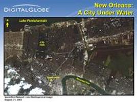
Satellite imagery of New Orleans denoting the flooded areas. [Source: DigitalGlobe] |
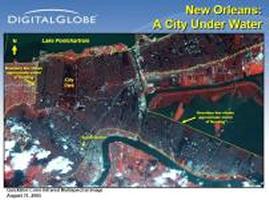 Satellite imagery of New Orleans denoting the flooded areas.
[Source: DigitalGlobe] |

|
NEWSLETTER
|
| Join the GlobalSecurity.org mailing list |
|
|
|