
New Orleans, LA
Pre- and Post-Hurricane Katrina
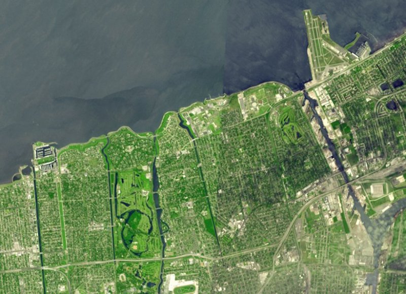
The imagery below is from the Advanced Spaceborne Thermal Emission and Reflection Radiometer on NASA's Terra satellite. The imagery shows New Orleans pre- and post-Hurricane Katrina. The before-image is an image mosaic acquired in April and September 2000 while the after-image was taken on September 13, 2005.
The flooded parts of the city appear dark blue, such as the golf course in the northeast corner, where there is standing water. Areas that have dried out appear light blue gray, such as the city park in the left middle. On the left side of the image, the failed 17th Street canal marks a sharp boundary between flooded city to the east, and dry land to the west. The images cover an area of 10.4 x 7.1 kilometers and are centered near 30 degrees north, 90.1 degrees west. Image credit: NASA/JPL
| Comparative ASTER satellite imagery of New Orleans pre- and post-Hurricane Katrina | |
| Toggle mouse over and off image for comparison | |
|
|
 Pre- and post-Hurricane Katrina comparative ASTER satellite imagery of New Orleans
|
|
NEWSLETTER
|
| Join the GlobalSecurity.org mailing list |
|
|
|