

Mapping ISIS / Caliphate
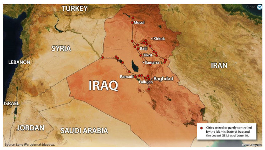
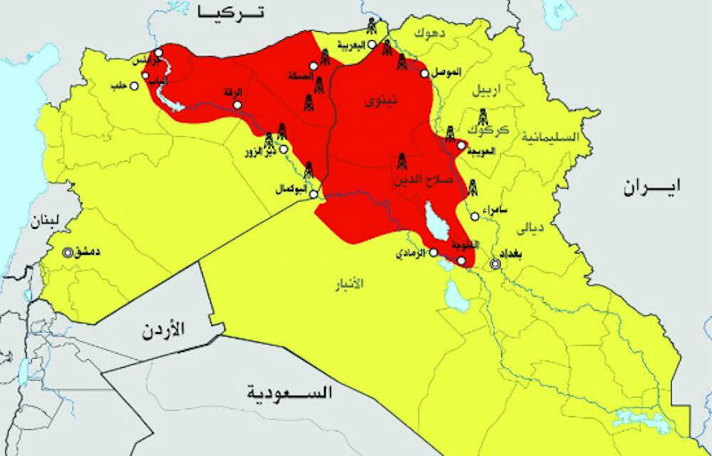
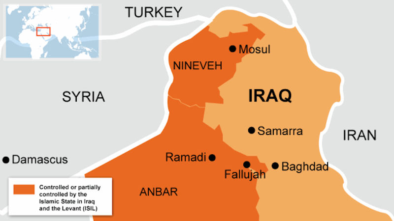
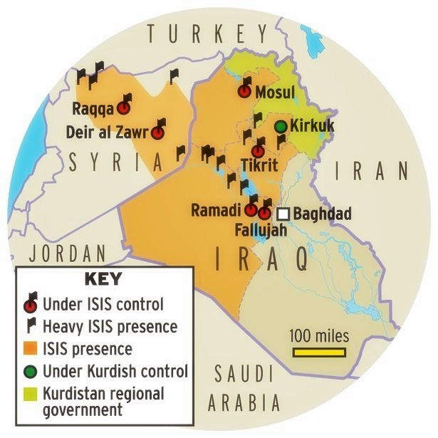
The developments of June 2014 posed a serious challenge to media cartographers. Some chose simply to depict the individual cities occupied by ISIS. Others connected the dots by stringing together the cities with the roads between them. Still others filled in the blanks with contiguous territory [much of which was sparsely inhabited and had been bypassed by ISIS combatants].
ISIS is typically described as having seized "vast swathes" of Iraq. The word swathe is not normally used in such a context, and its usage here probably reflects the difficulty in conceptualizing the extent of control under the Caliphate. The British pronounce and spell "swath" as "swathe" - the accepted spelling and pronunciation of the word in the UK. The word swathe is from the Middle English, from Old English *swæth; akin to Old English swathian to swathe - a footstep or trace; akin to Middle High German swade swath. The first known use was before the 12th century.
A swath is a long, wide strip of land, or an area of grass or grain that has been cut or mowed. The word may be used in reference to a row of cut grain or grass left by a scythe or mowing machine, or the sweep of a scythe or a machine in mowing or the path cut in one course. It is also seen as a long broad strip or belt; a stroke of or as if of a scythe; or a space devastated as if by a scythe.
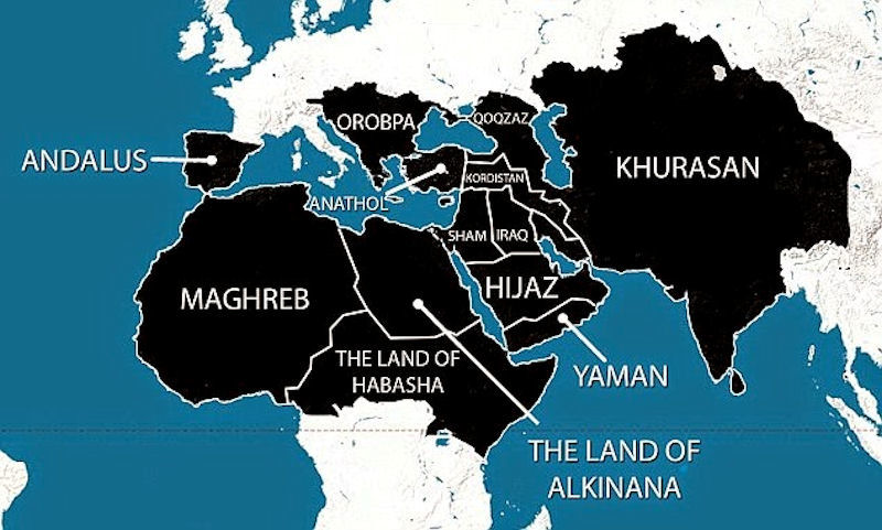
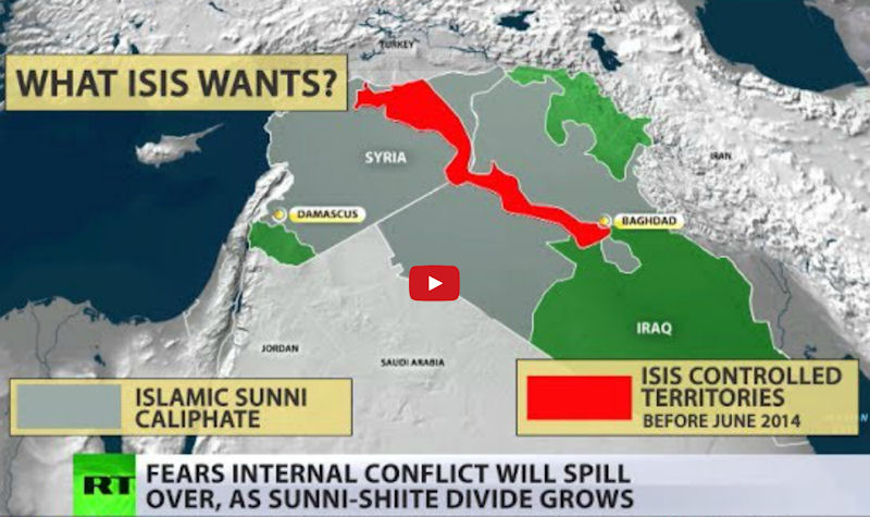
ISIS Ambitions


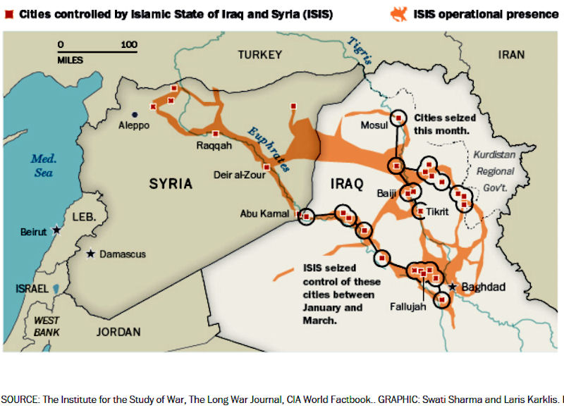
ISIS Cities
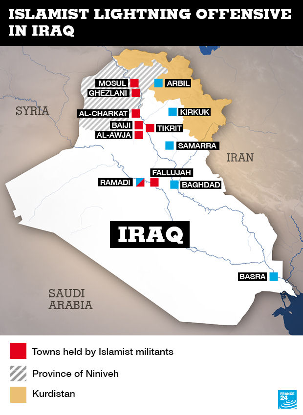

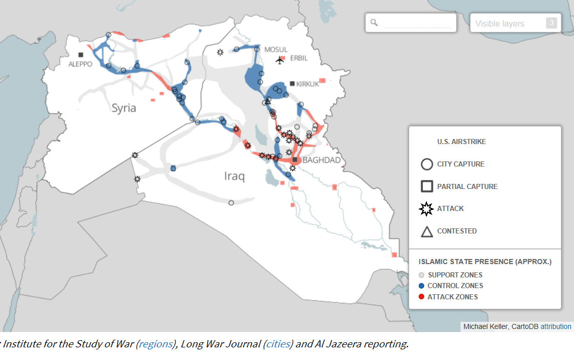
ISIS - Connecting the Dots
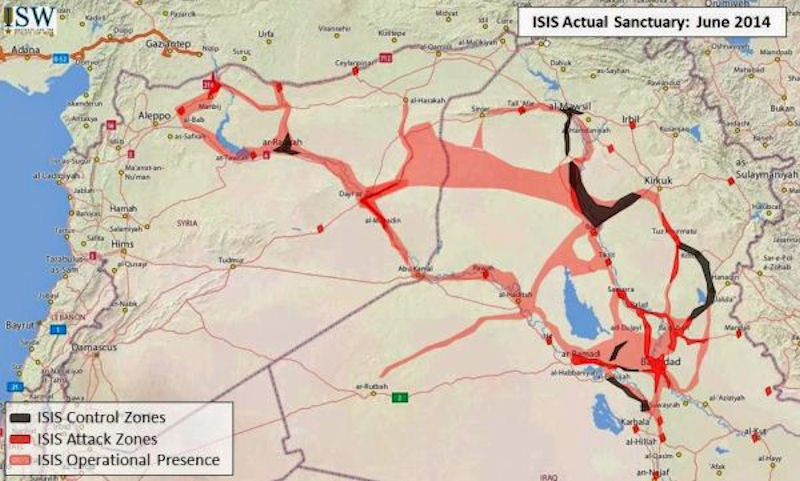


ISIS - Filling in the Blanks


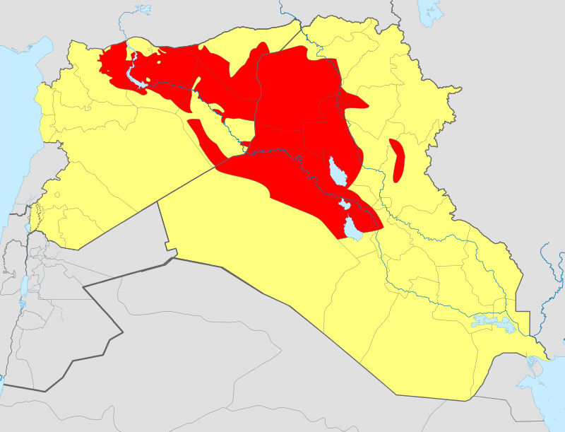

ISIS - Spreading Out


ISIS - Debka's Imagination

|
NEWSLETTER
|
| Join the GlobalSecurity.org mailing list |
|
|
|