

Port-au-Prince, Haiti
2010 Earthquake Satellite Imagery
Port-au-Prince, Haiti |
|
| Click on the small image to view a larger version | |
2010 Earthquake ImagerySatellite ImageryOperation Unified ResponseUS Operations in Haiti |
|
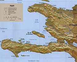
Country Map of Haiti (Map source: CIA - via Perry-Castaneda Map Collection |
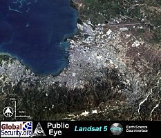
Port-au-Prince and surrouding area. Image Source: Earth Science Data Interface, University of Maryland. |
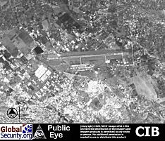
Overview of Port-au-Prince International Airport. (Image Source: National Geospatial Intelligence Agency) |
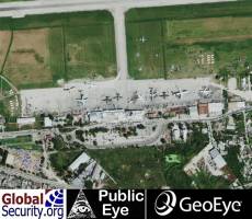
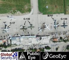
View of the Port-au-Prince International Airport from January 16, 2010. (Image Source: GeoEye) |
Close-up view of helicopters at the Port-au-Prince International Airport from January 16, 2010. (Image Source: GeoEye) |
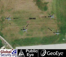
Close-up view of helicopters at the Port-au-Prince International Airport from January 16, 2010. (Image Source: GeoEye) |

| RQ-4 Global Hawk imagery of Haiti after the January 12, 2010 Earthquake |
|---|
| Click on the small image to view a larger version |
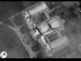
RQ-4 Global Hawk imagery of the Presidential Palace in Port-au-Prince, Haiti |
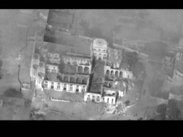
RQ-4 Global Hawk imagery of the National Cathedral in Port-au-Prince, Haiti |
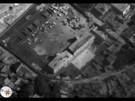
RQ-4 Global Hawk imagery of earthquake victims gathering in a soccer field in Port-au-Prince, Haiti |
|
NEWSLETTER
|
| Join the GlobalSecurity.org mailing list |
|
|
|