


Al Udeid Air Base, Qatar
25°06'57"N 51°18'55"E
| Imagery of Al Udeid Air Base |
||
| Click on the small image to view a larger version | ||

Overview of the Middle East with Qatar in the center |

The Persian Gulf with Qatar in the center |
|

CIA Map Qatar 1995 |

NIMA 1:500,000 Tactical Pilotage Chart of with an Ikonos browse image of the Al Udeid air base overlayed |
|
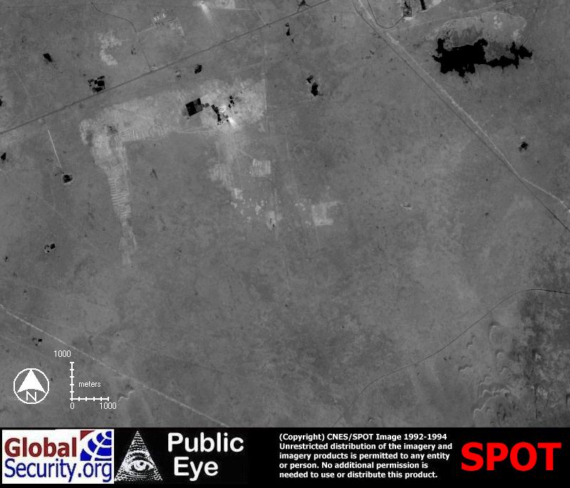
NIMA CIB as of 1992-94, before the Al Udeid air base was built |
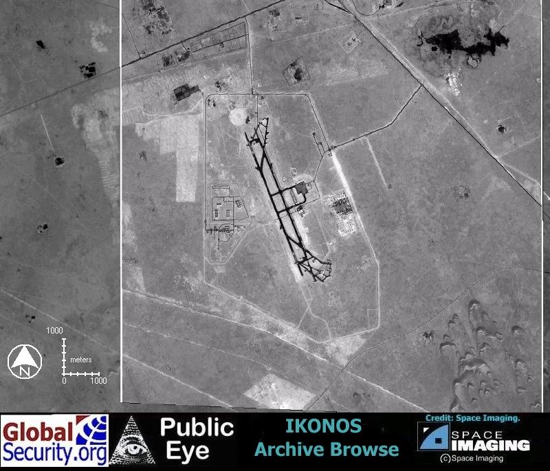
IKONOS Browse imagery of the Al Udeid air base as of 21 October 2001 |
|

IKONOS Browse of the Al Udeid air base |

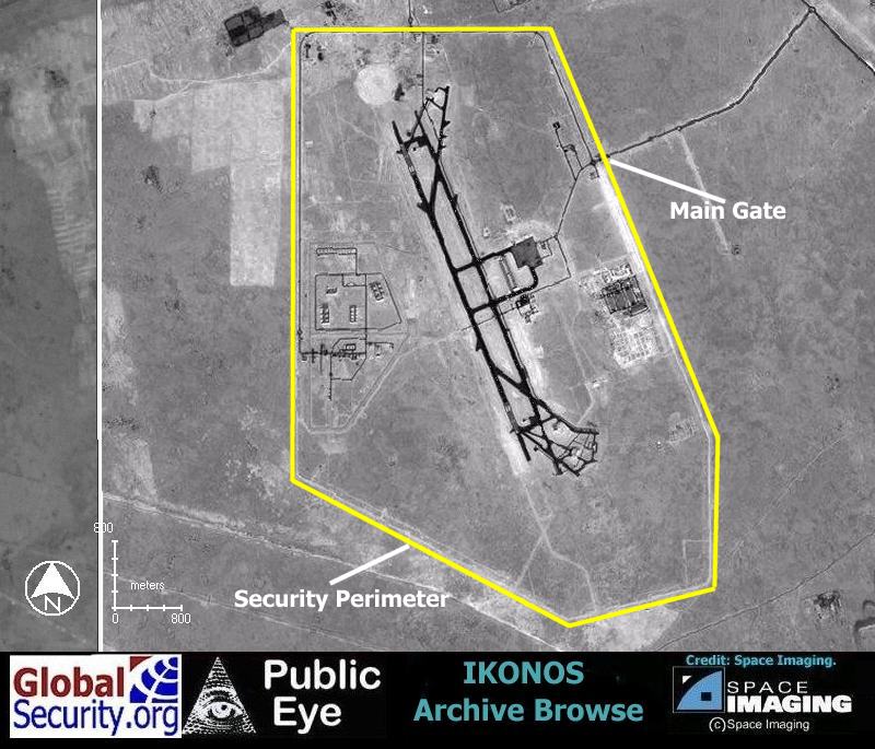
IKONOS Browse Imagery showing two main runways, with a base support area, aircraft disperal area, and munitions storage clearly visible |
|
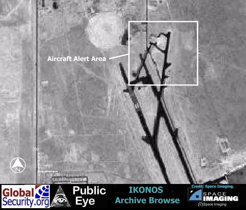
IKONOS Browse imagery of an aircraft dispersal and alert area at North end of the airfield. Examination of the full resolution Ikonos image would probably reveal several dispersed hardened aircraft shelters |
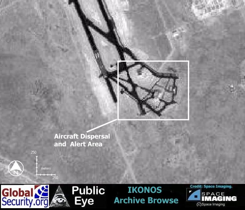
IKONOS Browse imagery of an aircraft dispersal and alert area at South end of the airfield. Examination of the full resolution Ikonos image would probably reveal several dispersed hardened aircraft shelters |
|
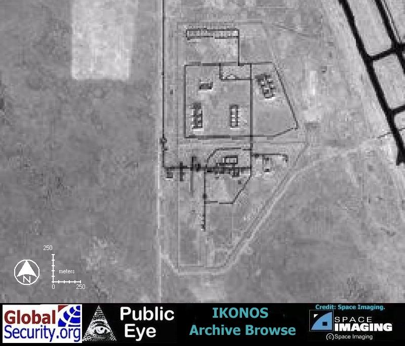
IKONOS Browse imagery of the Al Udeid munitions storage area. Individual storaage igloos are visiable as well as the security perimeter |
The Al Udeid air base is protected by a 20 kilometer security perimeter with an internal patrol road |
|
|
NEWSLETTER
|
| Join the GlobalSecurity.org mailing list |
|
|
|