

Cook Islands - Geography
 Big ocean, small islands describes the widely dispersed 15 islands with a total land area of 240 square kilometres and an Exclusive Economic Zone (EEZ) of two million square kilometrrs. Roughly 70% of the approximately 15,000 population live on the island of Rarotonga. The Cook Islands comprises 15 islands spread over 850,000 square miles (2.2 million square kilometers) of ocean smack in the middle of the South Pacific between Tonga to the west and the Society Islands to the east.
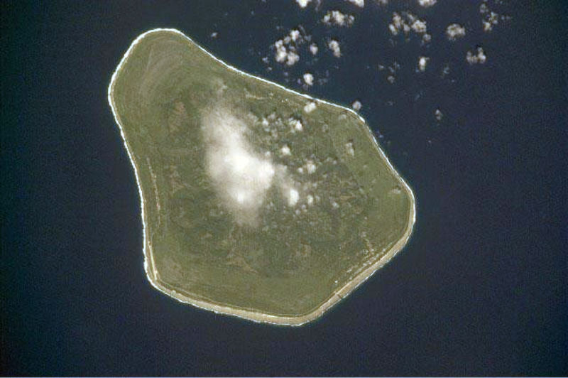
The Cook Islands consists of two main groups, one in the north and one in the south. The southern group is nine "high" islands mainly of volcanic origin although some are virtually atolls. The majority of the population lives in the southern group. The northern group comprises six true atolls. The differences between the volcanic "high islands" and coral "low islands" are quite apparent. Rarotonga, a circular high island described by many observers as one of the most beautiful in the Pacific, has a large number of well-defined peaks and pinnacles, including Te Manga, the highest, at 653 meters.


On 16 April 2009, the Cook Islands Government (CIG) submitted a claim to the UN Commission on the Limits of the Continental Shelf (CLCS) for control of over 400,000 square kilometers of the continental shelf underlying its surrounding waters and which extends beyond the CI,s Exclusive Economic Zone (EEZ). The claim, if granted, would allow the CI to control access to minerals on or under the seabed within the claim area. The authority for the CLCS claims process is provided within the UN Convention of the Law of the Sea (UNCLOS). Coastal nations may claim the right to control resources on or under the continental shelf (an undersea prolongation of the landmass) that extends outside the EEZ boundary of 200 nautical miles from shore.
The Cook Islands' Seabed Minerals Authority Commissioner says deep sea mineral extraction in the country will likely not go ahead if the environmental cost is too high. The sea floor is littered with metallic nodules consisting of manganese, cobalt, nickel and copper. Of these minerals, cobalt is the most valuable, and the CI EEZ is estimated by the Secretariat of the Pacific Community to contain enough cobalt to supply the world for 520 years. The mineable quantity of the nodules within the CI EEZ is estimated to be 7.5 trillion tons. However, mining the nodules is presently not cost-effective given available recovery technology and prices for the same land-mined minerals.
The Cook Islands (CIs) Exclusive Economic Zone (EEZ) encompasses 1,977,000 km2 and includes the Penrhyn and Samoa basins abyssal plains where manganese nodules flourish due to the availability of prolific nucleus material, slow sedimentation rates, and strong bottom currents. A group of CIs nodules was analyzed for mineralogical and chemical composition, which include many critical metals not before analyzed for CIs nodules. These nodules have varying sizes and nuclei material; however all are composed predominantly of d-MnO2 and X-ray amorphous iron oxyhydroxide. The mineralogy, Fe/Mn ratios, rare earth element contents, and slow growth rates (mean 1.9 mm/106 years) reflect formation primarily by hydrogenetic precipitation. The paucity of diagenetic input can be explained by low primary productivity at the surface and resultant low organic matter content in seafloor sediment, producing oxic seafloor and sub-seafloor environments. The nodules contain high mean contents of Co (0.41%), Ni (0.38%), Ti (1.20%), and total rare earth elements plus yttrium (REY; 0.167%), and also high contents of Mo, Nb, V, W, and Zr. The CIs EEZ shows a significant resource potential for these critical metals due to their high prices, high demand, and the high nodule abundance, which will allow for a smaller footprint for a 20-year mine site and therefore smaller environmental impact.
Rarotonga - the 'down south' island - is the youngest island in the Cook Islands southern group and is physically unlike its other volcanic neighbors where erosion and periodic submersions have reduced mountains to gentle hills. Rarotonga's central massif is the eroded remains of a once mighty volcanic pyramid whose crags now form sawtooth peaks and razorback ridges covered with tropical jungle. These are separated by streams running down steep valleys.
The island stands 14,750 feet (4500m) above the ocean floor. It is 20 miles (32k) in circumference. At a depth of 13,000 feet (4000m) the volcano is some 31 miles (50k) in diameter. The highest peak is 2140 feet (658m) above sea level and the island is surrounded by a lagoon which extends several hundred yards to the reef which then slopes steeply to deep water. Around the central mountainous area of this beautiful island is a narrow band of agricultural terraces and flats which, in turn, is encircled by a ring of swamps used largely for growing taro.
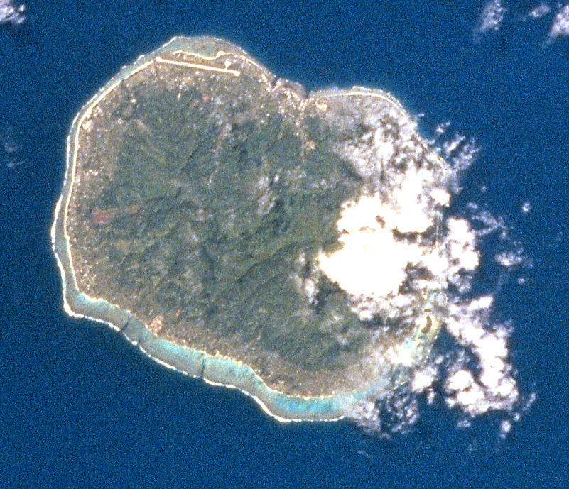
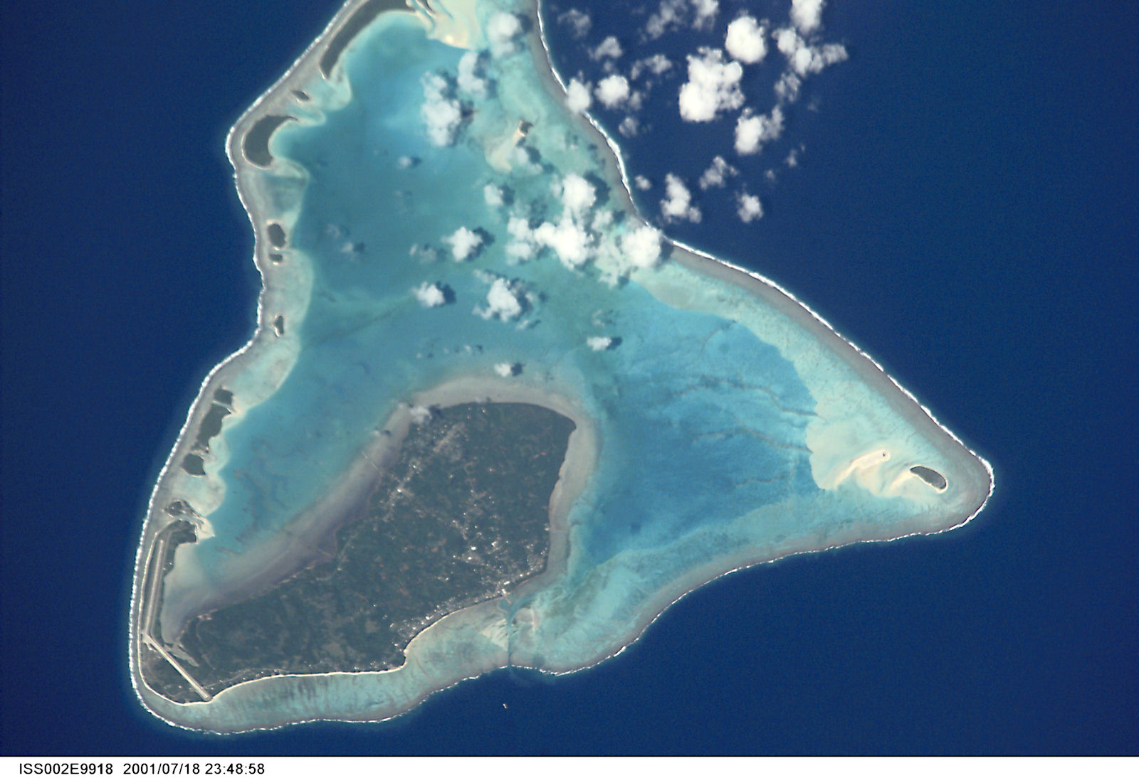
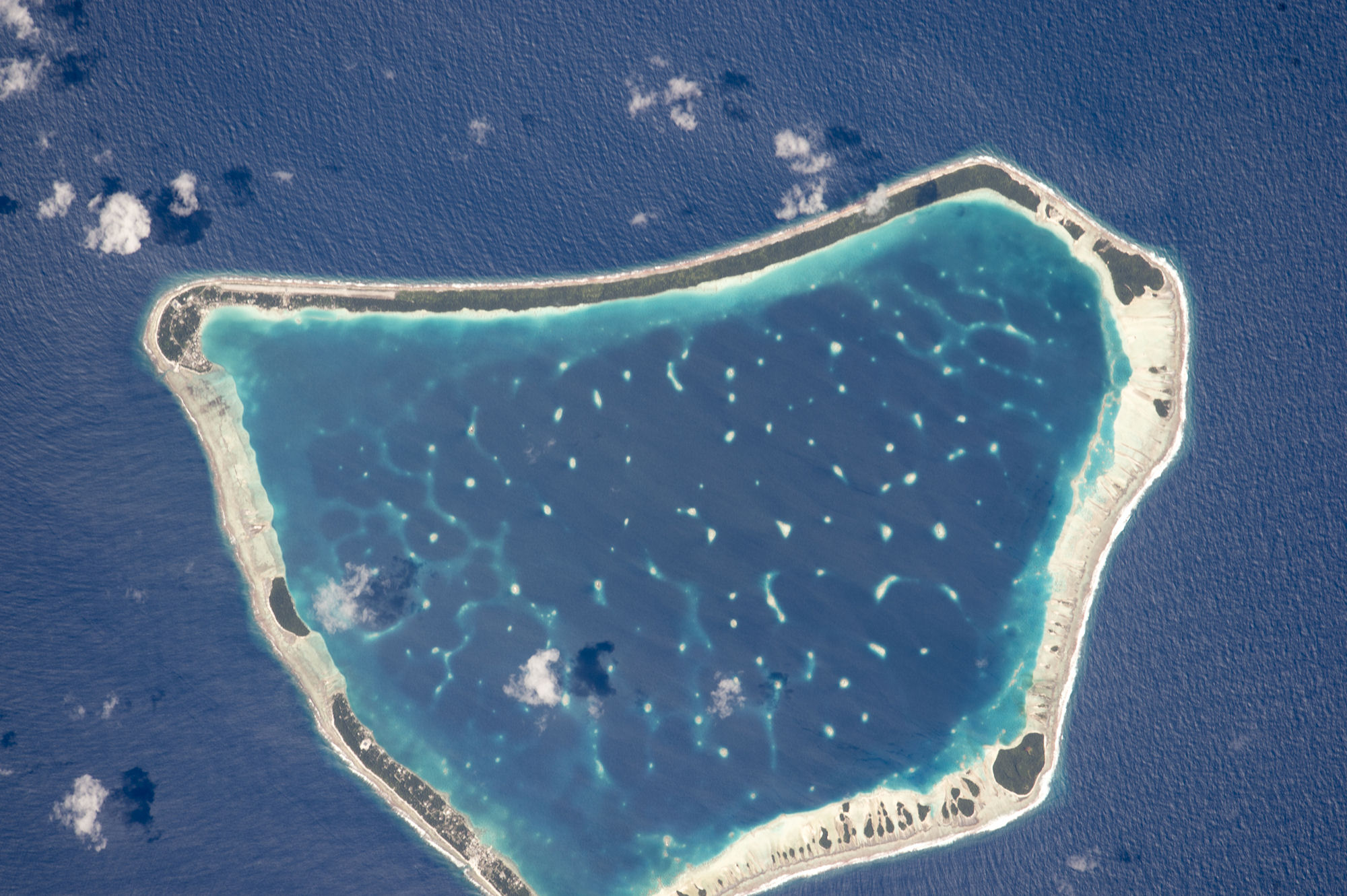
The Cook Islands are the result of volcanic activity and coralgrowth in the centre of the South Pacific Basin. The islands of Rarotonga, Mangaia, Atiu, Mauke, Mitiaro and Aitutaki are the emergent peaks of extinct volcanoes. Manuae, Palmerston, Penrhyn, Manihiki, Rakahanga, Pukapuka, and Suwarrow are atolls, that is coral reefs around a lagoon on the top of submerged volcanoes. Takutea and Nassau are sand cays on a coral reef foundation.
Aitutaki is part volcanic, part atoll; it is also called a near-atoll. Aitutaki in the Southern Cook Islands has a distinctive equilateral triangular shape (roughly 12 km (7.5 mi) on each side). It is an "almost atoll" whose coral reef barrier does not extend above the ocean along its southern side.
The islands of Mauke, Mitiaro, Atiu, Takutea, Manuae, the Eclipse Sea-mount (between Manuae and Aitutaki), Aitutaki, and after a small depression Palmerston form a linear volcanic chain with Wnw trend. This chain, a continuation of the Austral Islands chain, is probably due to a major fracture in the crust of the earth. Rarotonga and Mangaia are on the crest of a separate arch surrounding the Mauke -Aitutaki chain. Rarotonga is probably due to crustal responses to the continued sinking of the main Mauke-Aitutaki group.
The volcanic activity of the Mangaia, Atiu, Mauke and Mitiaro volcanoes was followed by subsidence: the peaks sank below sea level, and barrier reefs grew around the submerged peaks. Later the peaks and surrounding reefs rose slowly above the surface of the ocean, or the level of the sea dropped beneath the peaks and coral reefs. A new coral reef grew around them below sea level. The raised coral reef surrounding the emergent peaks is called makatea. The four islands are raised coral or makatea-type islands.
The atolls of the Northern Group, except Penrhyn, rise from the periphery of a broad, shallow platform, which is termed the Manihiki Plateau. This plateau, 2,5003,000 meters below sea level, and covering an area of 600,000 km2, is thought to be one of the micro-continents of long ago. It is sited along the axis of the Darwin Rise, and was probably levelled in the Cretaceous (136 to 65 million years ago).
Manihiki-Rakahanga are on the Nne-trending eastern margin of this plateau, and Pukapuka, Nassau, and Suwarrow are on the Wnw-trending southern margin. Penrhyn lies between the Manihiki Plateau and the Line Islands, and is the highest of the extinct volcanic mountains of the Cooks with a relief of over 4,876 meters.
Niue, once within the political boundaries of the Cook Islands (1901/3), does not belong to any of the Southern Cooks' mountain chains. It is an isolated coral island near the head of the Tongan Trench, entirely composed of limestone, which caps a submerged volcano. About 30 km to the east are two Seamounts: the Endeavour and Lachlan Seamounts. A third, smaller seamount, lies 30 km to the south-east.
The eruptive phase of the Cook Islands volcanoes, except Rarotonga, took place in the early Tertiary age (Palaeocene), some 65 to 60 million years ago. It is thought that the Northern group volcanoes stood high above sea level at that stage. They subsided during the Eocene (60 to 38 million years ago).
|
NEWSLETTER
|
| Join the GlobalSecurity.org mailing list |
|
|
|