

Golan Heights - History
 Historically, the Golan Heights had never been a part of a unified Jewish state, and the region had not contained a significant Jewish population for 3,000 years. The Ottoman Empire, the last of a millenium-long succession of Muslim rulers, governed the area until the end of the Great War. Then France assumed control of it as part of the League of Nations Mandate for Syria, while Britain assumed control of the neighboring Mandate for Palestine. In 1922 the two countries established an international boundary.
Al-Munjid Al-Geographical Dictionary states that the plateaus east of the Jordan River were called Golan due to the type of soil that the winds blew and the many wars that took place on its land. Al-Qamoos Al-Muhit states that Golan and Golan are soil that the winds swept. The Golan Heights were also called in ancient times Al-Shaara, meaning the land with many trees. It is associated with movement and migration, and also means high ground. It was said that it is attributed to the horses and armies that roamed the battles that took place in those lands.
The name of the Golan was mentioned in the poetry of Al-Nabigha Al-Dhubyani in the pre-Islamic era, and the poetry of Hassan bin Thabit in Islam. Shams Al-Din Al-Maqdisi mentioned it in his book The Best Divisions in the Battle of the Regions and said, It is a high place located on the borders of Al-Hula at the foot of Mount Hermon.
The Golan was mentioned in a number of Islamic heritage references, as a region, a district, or a province. It was also mentioned in some of them as a mountain, a village, and a city. It was also mentioned in ancient works with different names, such as: Joflan, Golanits, Golanitid, Golantih, Jaflan, and Galania.
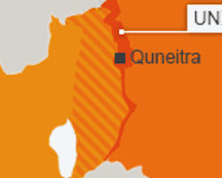
"Golan" has become an administrative term that has been used synonymously with the name of Quneitra Governorate since 1964, according to the Syrian regional geographical divisions.
The Golan Heights witnessed two of the greatest Arab battles, Yarmouk and Hattin, and has been subjected to border changes and alterations throughout history, due to its strategic location, unique geographic nature, economic wealth and water resources. Settlements were established on its lands, forming a productive depth for Israel, a food and water storehouse and an important defensive area.
The territory now known as the Golan Heights is a tiny part of the "fertile crescent," the ancient pathway around the deserts of Jordan, Syria, and Iraq that has been a route of trade, migration, invasion, and shifting political control throughout recorded time. Although this particular area was never a part of a centralized Jewish state in the modern sense, ruins of Jewish synagogues on the Heights are continuing evidence of Jewish settlement there during the Second and Third Centuries AD. Following the fall of Jerusalem to the Romans in 70 AD and the subsequent Jewish dispersion, the entire region eventually came under the control of the Byzantines and later of a series of Muslim powers-periodically interrupted by Crusaders, the ruins of whose castles still dot the area.
The Ottoman Empire (1517-1917), the last of the Muslim sovereigns over the area, ended with the Great War. Near the end of Ottoman rule, several Jewish philanthropists bought land in various areas of the Middle East for the resettlement of Jews from Europe and Russia. Although most of these purchases were in Palestine, two such resettlement communities were attempted on the Golan Heights. During th Great War, the British, French, and Italians encouraged the Arabs to revolt against Turkish rule by promising them independence. After the war, however, the Allies reneged on their promise and divided up the territory into Mandates under the League of Nations.
The boundary between the British Mandate for Palestine (out of which Israel was carved) and the French Mandate for Syria (which included the Golan Heights and present-day Lebanon) was demarcated by an Anglo-French boundary commission in 1922 and formally accepted by those governments in March 1923. The boundary is about 65 kilometers long and extends from the current Lebanon-Syria-Israel tripoint to the present Jordan border (then British Transjordan).
In 1946, the French Mandate was divided and Syria gained its independence. In 1948, when Britain withdrew from Palestine, Syria and four other Arab states attacked the new state of Israel as it fought to establish its borders within Palestine. The Armistice Agreement signed in 1949 left Syria in control of three small regions in northern Israel. Although they were demilitarized, competition and conflict over the three regions gradually escalated and in 1967 provided Israel with its primary justification for invading Syria following its successful attacks on Egypt and Jordan.
The Syrians reasoned that since they had controlled the zones at the time the armistice was signed they had an obligation to protect the rights of Palestinian Arabs living there. The Israelis contended the zones were part of their territory based on the UN Partition Plan. The Israelis claimed that the only limit on their authority in the demilitarized zones was the prohibition on troops and military activity and that the chairman of a Mixed Armistice Committee appointed by the United Nations had authority only over the return of civilians to the zones and the hiring of local residents as police.
The Armistice Agreement directed that farming in the demilitarized zones be quickly restored to pre-hostility levels but gave no guidance on how the land was to be returned to its owners. The problem was complex because the fields of Arab and Jewish farmers often abutted and in some places were intermingled. Both Syria and Israel used the expansion of agricultural holdings as a means to establish control. As farmers returned to the war-ravaged zones, numerous disputes over land ownership occurred. The Syrians back their own participants in local disputes, and disagreements quickly escalated to shootings-and on occasion to more serious military actions involving armored vehicles and artillery.
By early 1967 artillery exchanges and even airstrikes were occurring fairly regularly. The climax came on 09 June 1967 when Israel invaded Syria following its earlier attacks on Egypt and Jordan. Israeli forces captured the demilitarized zones and penetrated about 25 kilometers into Syria, occupying about two-thirds of the Syrian Province of Al Qunaytirah. By the time a cease-fire was arranged, Israel was in control of two-thirds of Syria's agriculturally prosperous westernmost Province of Al Qunaytirah; it subsequently renamed the region the Golan Heights. In response to a UN Security Council demand, a cease-fire was implemented on 10 June. During the next several days the line that marked the limit of advance of the Israeli forces was demarcated by UN observers. A buffer zone ranging in width from a few hundred meters to 2.5 kilometers was established east of this line.
Along with Egyptian attacks on the Sinai, in 1967 Syrian forces launched a surprise attack on Israeli positions in the Golan Heights and penetrated the center of the Israeli line, passing to the south of Al Qunaytirah and isolating several pockets of Israeli troops. By the morning of 7 October the southernmost Syrian elements had almost reached Al Al, about 10 kilometers east of Lake Tiberias, while in the north the penetration was shallower. The Israelis counterattacked on 7 October, and by 10 October the Syrian forces had retreated east of the 1967 cease-fire line except for units still holding a portion of Mount Hermon. By 14 October the Israeli forces had carved out a roughly semicircular area that stretched from the lower slopes of Mount Hermon almost to Sasa, about midway between Al Qunaytirah and Damascus, and rejoined the cease-fire line southeast of Al Qunaytirah. For the next 10 days the Israelis directed most of their efforts toward holding the 600-square-kilometer semicircle, although they also recaptured their positions on Mount Hermon. Large-scale hostilities ended on 24 October, but hostile incidents, snipings, and occasional artillery exchanges continued during the winter and spring while US Secretary of State Kissinger practiced shuttle diplomacy.
Israel occupied the Golan Heights as part of the June 1967 war, expelled more than 95% of its population, approximately 140,000 Syrian citizens, demolished their villages (340 villages and the city of Quneitra), and planted 76 minefields containing approximately two million mines, some of which were inside and around populated villages.
Until the October 1973 war, the occupation divided the settlement plans in the Golan into 4 regions, where it prepared the slopes of Mount Hermon and the northern Golan for tourist purposes, and built a military observation point on the mountain to supervise Syria, and they built a synagogue on it to falsify its features.
The Disengagement Agreement was concluded on May 31, 1974, between Syria and Israel in Geneva, in the presence of representatives of the United States, the United Nations, and the former Soviet Union, with the aim of separating Syrian and Israeli forces in the area. The agreement established a buffer zone, as well as two equal zones of limited forces and weapons for both parties on either side of the zone.
On 06 June 1974 Israeli and Arab forces began a staged withdrawal. Under the agreement, Israeli military forces pulled back to positions west of "Line A," which coincided with the 1967 cease-fire line except near Ar Rafid and Al Qunaytirah. From just north of Al Qunaytirah Line A swings westward and then southeastward to rejoin the 1967 cease-fire line. An additional line termed "A-1" forms a bulge on Line A around Al Qunaytirah, in which Israeli civilians, but The arrangement went into effect on 26 June 1974 and remains current, subject to renewal every six months (in May and November). not military forces, are permitted. All territory east of Line A is under Syrian administration and with the exception of Al Qunaytirahwhich was largely destroyed after the cease-fire by withdrawing Israeli units was gradually repopulated by Syrian civilians. Syrian forces are required to remain east of "Line B"; the area between Lines A and B is the zone of separation where the United Nations Disengagement Observer Force (UNDOF-strength about 1,250) is stationed to maintain the cease-fire. UNDOF also monitored the bulge between Lines A and A-1. East and west of Lines A and B are areas in which forces and armaments are limited as specified in the disengagement. In addition, the need for Syria and Israel to negotiate the future of the Golan Heights and to conclude a peace treaty was specifically mentioned in the Camp David Accords.
The buffer zone is manned by a peacekeeping mission mandated to monitor the agreement, which came after months of fighting in a war waged by Egyptian and Syrian forces against Israel in October 1973. United Nations established a peacekeeping force on 31 May 1974 "following the increasing instability in Israel and Syria, and the intensity of the firing in early March 1974, under Security Council resolution 350 (1974) to follow up on the disengagement agreement between Israeli and Syrian forces in the Golan.
Since 1974, a UN peacekeeping force known as UNDOF patrolled the buffer zone between the Israeli and Syrian-controlled areas. While Israel and Syria remained officially at war, the area has been relatively calm, aided by a peacekeeping mission that has continued to operate in the area so far, despite breaches that have occurred as military activity has escalated in the area.
The United Nations renewed the mandate of the force more than once, most recently in June 2024, when the UN Security Council decided to extend its mandate until December 31, calling on Syria and Israel to "strictly and fully respect the terms of the 1974 disengagement agreement, and the Security Council requested the Secretary-General of the United Nations to ensure that the force is provided with the necessary capacity and resources to carry out its mandate in a safe manner."
In the central Golan region, the occupation established semi-military settlements and military service projects, and in the south it encouraged agricultural work and the establishment of factories for the aviation industry. As for the lowland region from Yarmouk to the coast of Tiberias, it was used for protected agriculture purposes. The occupation authority established, in stages, 33 agricultural settlements and the city of Katzrin - an administrative center for the settlements, which they call the capital of the Golan - on the ruins of the Syrian villages. The number of settlers there is 26,261.
In 1981, the occupation authority officially approved the annexation of the Golan through the Golan Heights Law issued by the Knesset, and renewed this confirmation on November 28, 2023. The UN Security Council in 1981 unanimously passed a resolution opposing Israels occupation of the Golan Heights, calling on Israel to rescind its imposition of Israeli law on the plateau. It declared Israels rule over Golan null and void and without international legal effect.
In 1981, more than 90% of the population of the occupied Golan Heights rejected Israeli citizenship. As a result, most of the population now holds a travel document that identifies their nationality as undetermined (i.e., they are neither Israeli nor Syrian citizens). The conversion of the population to Israeli citizenship implied the de facto annexation of the Golan.
Israel has been trying to obtain recognition from major powers for its annexation of the Golan Heights. In 2019, US President Donald Trump recognized this, and then established a new settlement in his name in the Golan Heights. On December 26, 2021, the Israeli government, headed by Naftali Bennett , approved a plan to double the number of Jews in the Golan by 2030, with an initial budget of $1 billion, with the aim of attracting 23,000 Jews to live in the area.
On 25 March, 2019 President Donald Trumped signed a proclamation, formally recognizing Israel's sovereignty over Golan Heights. The announcement came as raeli Prime Minister Benjamin Netanyahu visited the White House. UN Security Council Resolutions 242 and 497, both supported by the United States, provide the legal basis stating that Israeli unilateral annexation of Syrian territory is in violation of international law. There was more than a security and water-resource dimension to the US recogniion of Israeli sovereignty over the Golan.
President Donald Trump's announcement wouldo set a precedent that territory can be captured in war in violation of international law. Russia, for example, will take note of the inconsistency after five years of Western condemnation following its annexation of Crimea from Ukraine in 2014. Russian Foreign Minister Sergei Lavrov condemned US President Donald Trump's recognition of the Israeli regime's "sovereignty" over the occupied Golan Heights, stressing the need for a political solution to the conflict in Syria in accordance with UN Security Council Resolution 2254. "We reject the US president's decision on the occupied Syrian Golan, which flagrantly violates the UN Charter," Lavrov said at a joint press conference with his Jordanian counterpart Ayman Safadi in Amman on 07 April 2019.
|
NEWSLETTER
|
| Join the GlobalSecurity.org mailing list |
|
|
|