

The Fence / Security Barrier / Separation Barrier
The "fence" is a grim looking structure that is part barbed wire, part electrified metal, and part high concrete wall with a watch tower and sniper positions. It is designed to keep Palestinian militants out. Israel's frontier with the West Bank is 365-kilometers long. The Government has decided to fence the whole line. About $1.5 billion was allocated for the first two stages of the project. It takes different forms in different areas. There are areas of the wall that are a huge concrete wall 8 meters high. It has watchtowers every few hundred meters, very similar to the Berlin Wall. On either side of the wall are 'buffer zones' so property is destroyed if it's too close to the wall. There are also trenches and a series of military roads with barbed wire on either side of the wall.
| Satellite Imagery of the Fence |
|
Maps
|
|
| Click on the small image to view a larger version | |
| Israel Security Fence - Ministry of Defense | |
| The map supplied by the Israeli government shows the true situation on the ground and does not resort to overt propaganda. They simply show where the fence is and where it is being built, nothing more and nothing less. | |
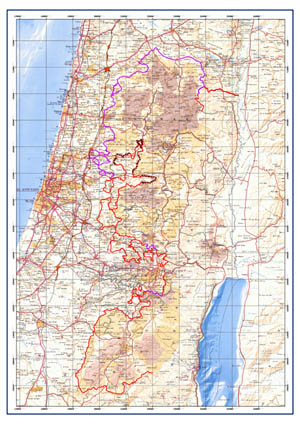 Israel Security Fence - Ministry of Defense |
|
|
|
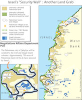
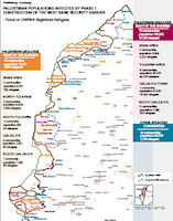
| PLO Negotiations Affairs Department Maps of the Israeli security wall construction | |
| The PLO Negotiating Affairs Department's maps of the barrier are partisan and incorrect in some respects. They show the eastern portion of the barrier as definite and with an already established route. This is incorrect. The concept of an eastern security barrier has been approved by the Israeli cabinet, but as yet no route has been shown. A common misconception going around currently is that a route that has been reported as 'proposed', and there has been no information by those who bring it up as to who proposed it or whether it's approved, is the actual planned barrier, and representing it as such in this map misleads the public. Furthermore, the use of the term "Israeli Colonies" in those maps is another example of partisan language. | |
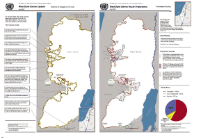 West Bank Barrier, April 2007. Source United Nations 2007 |
|
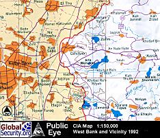 1:150,000 scale map of a portion of the West Bank. Source CIA 1992 |
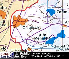 Overview of the West Bank town of Qalqilyah. Israeli settlements are blue. |
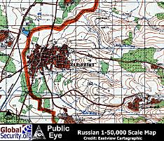
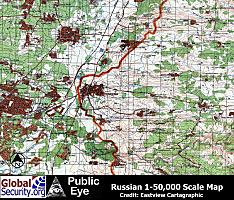 Russian 1:50,000 scale map of portion of the West Bank. Source Eastview Cartographic |
 This russian map from 1990 shows area east of Qalqilyah prior to the expansion of the Israeli settlements Alfe Menashe and Zofim |

|
|
 |
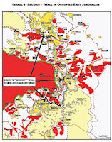 Map of the Security wall around East Jerusalem. Source: PLO Negotiations Affairs Department |

|
NEWSLETTER
|
| Join the GlobalSecurity.org mailing list |
|
|
|