


Al Sahra Airfield
| Imagery of the Al Sahra Airfield |
|
| Click on the small image to view a larger version | |

Overview of the Middle East with Iraq in the center |

CIA Map of Iraq |
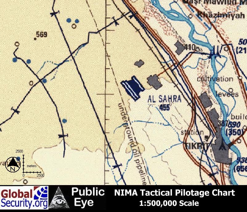
Tactical Pilotage Chart of the Al Sahra Airfield |
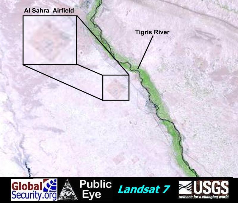
Landsat 7 imagery of the Al Sahra Airfield. Vegetation inside the base perimeter defines the boundary |
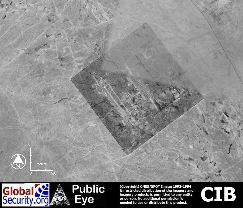
CIB imagery of the Al Sahra Airfield, as of 1995 |
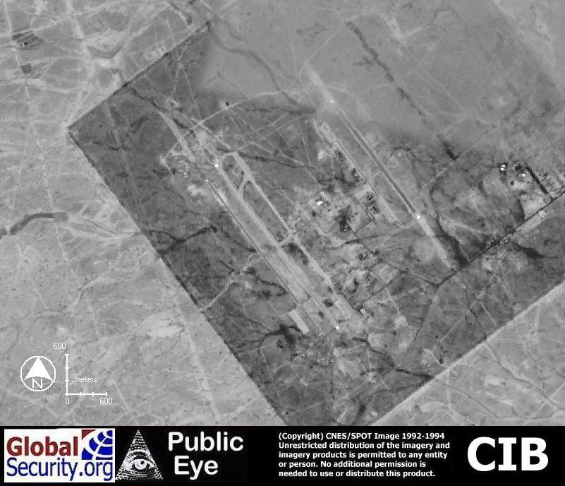
CIB imagery of the Al Sahra Airfield, as of 1995 |
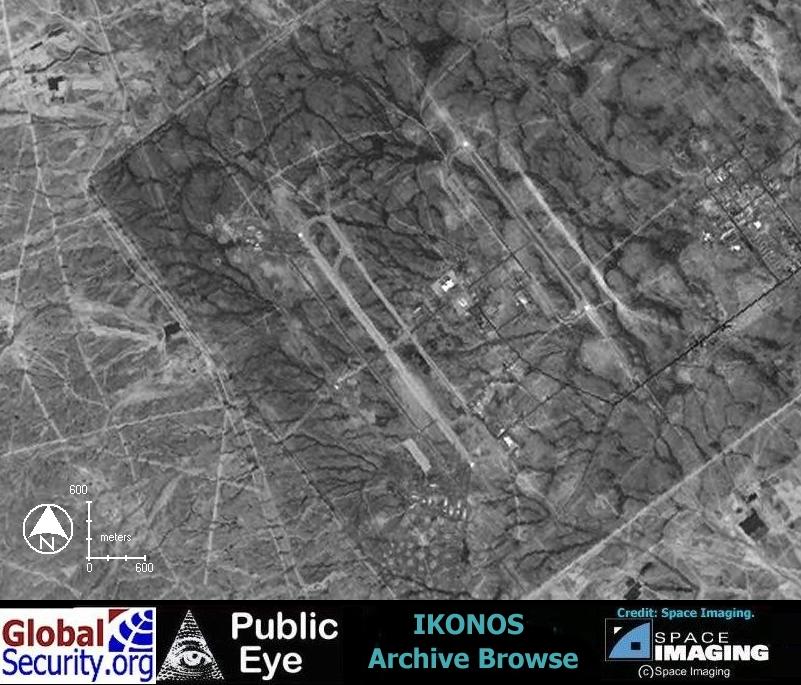
Ikonos browse imagery of Al Sahra Airfield as of April 6, 2001 |
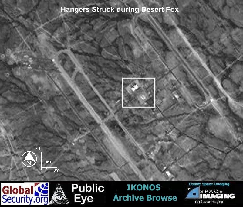
Ikonos browse imagery of Al Sahra Airfield as of April 6, 2001. The area in the box was struck during Operation Desert Fox in December 1998 |
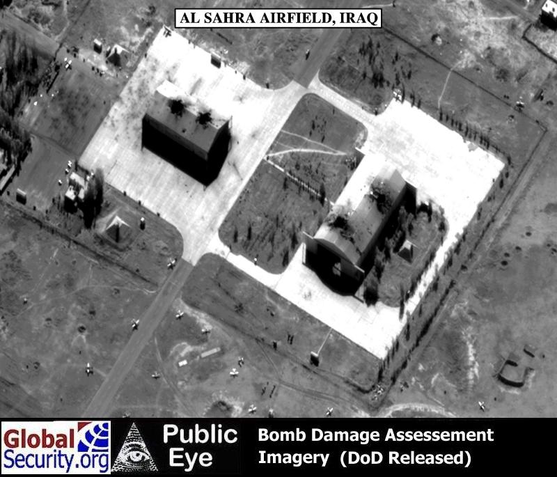
DoD released imagery of Al Sahra Airfield struck during Operation Desert Fox in December 1998 |
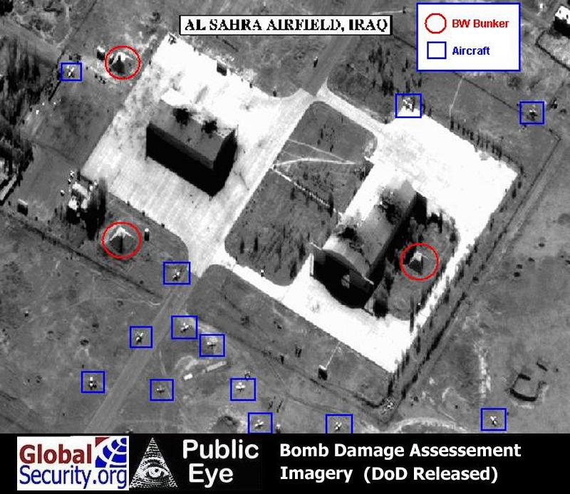
DoD released imagery of Al Sahra Airfield struck during Desert Fox. Visible are possible BW storage bunkers and aircraft that could be used for aerosol dispersal |
|
NEWSLETTER
|
| Join the GlobalSecurity.org mailing list |
|
|
|