

Pyongyang, North Korea
| Imagery of Pyongyang, North Korea. | |||||||||||
| Click on the small image to view a larger version |
 For more Public Eye satellite imagery, see the Picture of the Week Gallery of satellite and other imagery of places in the news.
|
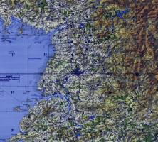 TPC Map of North Korea
|
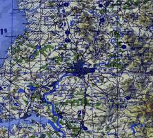 TPC Map of the area around Pyongyang, North Korea.
|
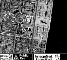
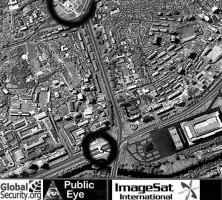
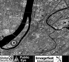 Overview of Pyongyang, North Korea. (Image Credit: ImageSat International)
|
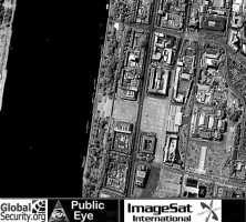
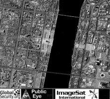 Overview of the area along the Taedong River. (Image Credit: ImageSat International)
|
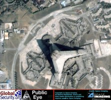
 Focus on Juche Tower. (Image Credit: ImageSat International)
|
 Focus on Kim Il Sung Square. (Image Credit: ImageSat International)
|
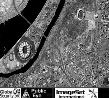 Overview of the area around the May Day Stadium. (Image Credit: ImageSat International)
|
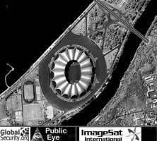 May Day Stadium in Pyongyang. (Image Credit: ImageSat International)
|
 Two of the many monuments in Pyongyang. (Image Credit: ImageSat International)
|
 The Ryugyong hotel. (Image Credit: Space Imaging) |
|
NEWSLETTER
|
| Join the GlobalSecurity.org mailing list |
|
|
|