

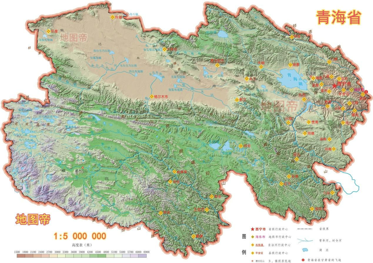
Qinghai-Tibet Plateau
 The Qinghai-Tibet Plateau (QTP) is the largest, highest and flattest plateau in Earth with an average elevation exceeding 5000 m. It is bound by the deserts of the Tarim and Qaidam Basins to the north, the Himalayan, Karakoram, and Pamir mountain chains to its south and west but its eastern margin is more diffuse. The famous Qiangtang Grasslands on North Tibet spreads from east to west over 2,400 kilometers and from north to south over 700 kilometers, averaging 4,500 meters at sea level. The boundless grassland is the principal pastoral area in Tibet. There are many no mans lands distributed in the western region of the QTP, including Altun National Nature Reserve, Changtang Nature Reserve, Hoh Xil Nature Reserve, etc. These regions were inaccessible and had high elevation and limited trafficability of land surfaces.
Tibet has often been called the "Roof of the World." Tibet Plateau is the main body of the Qinghai-Tibet Plateau, consisting of high mountains and great rivers, prairie and gorges. On the Tibet Plateau stands the world-famous Himalayas in southwest, the Kunlun Mountains and the Kalakunlun Mountains spread the northwest, the Gangdisi, Tanggula and Nyainqentanglha Mountains traverse the middle, and the Hengduan Mountains is its east barrier. There are 6 peaks of over 8,000 meters at sea level, 50 peaks of over 7,000 meters at sea level and numerous peaks of over 6,000 meters at sea level in Tibet, where the world's highest summit Mt. Everest erects with an elevation of 8848.13 meters.
Amidst the numerous high and gigantic mountains spread a range of hills, lakes and gorges, constituting undulation alpine prairie. Qiangtang, which means "northern highland," refers to the north Tibetan plateau. Located among the Kunlun, Tanggula and Gangdese Mountains, its land area covers 2/3 of the whole of Tibet. Its total area is more than 600 thousand square kilometers, averaging about 4,500 meters above sea level. Cold, windy and snowy for eight or nine months a year, frozen land can be seen everywhere. An old folk song is sung like this: "The mysterious Qiangtang, it is so wild and desolate when you are here the first time; it becomes your lovely hometown when you get to know more."
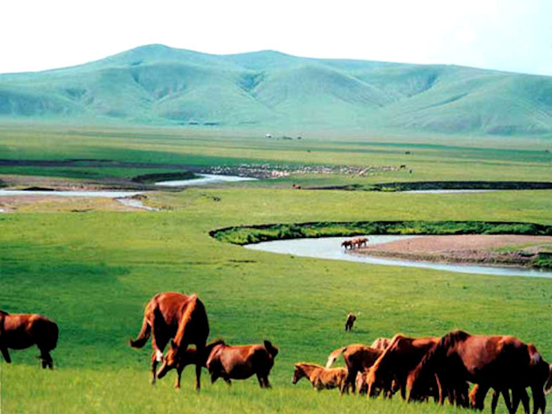 The north of Qiangtang Plateau is even called No People Area, thus, the place is an ideal living area for rare animals, including north of the Gangdese Mountains, Nyainqen-tanggula Mountains and the wide area south of Kunlun Mountains. The Qiangtang Grassland features thousands of wild animals in the area. Forty of them have government protection. Such rare animals as Wild yaks, Bharals, Tibetan wild donkeys, White-lipped deer, are being well preserved in the area.
The famous "plateau boat" Yak and Tibetan antelope live in the area. The herdsmen's homes are mostly located at the foot of the mountains and la kesi des. When summer comes, they put their simple packing on horseback, herding nomadically on the boundless prairie, their melodious songs accompanying their wandering footsteps. The herdsmen shake away the long loneliness by hard work and singing in nature's harshness, creating a beautiful and colorful life.
The plateau is probably the largest and highest area ever to exist in Earth history, with an average elevation exceeding 5000 m (16,400'). From the view of earth science, Tibet plateau is one of the most interesting regions in the world. It is the highest plateau in the world, with an average altitude 4,500 meters. Tibet Plateau has many firsts as following: It has the highest mountains in the world Mt. Qomolangma 8,850 meters. It has the largest canyon in the world Yarlung Zangbo River Great Canyon with a total depth 5,382 meters. It has the largest scale of vertical eco-system zones, from the highest point on the earth 8,850 meters, to the bottom of valley 900 meters elevation. It has numerous glaciers and originations of many important rivers are here. It has very unique environment and many unique plateaus.
The Qiangtang Basin is a large endorheic basin in the inner part of the Tibetan Plateau, and has been thought to be a dry region in contrast with the surrounding wet outer region that feeds all the major Asian rivers. A significant amount of rain water in the Qiangtang Basin leaks out by way of groundwater flow through deep normal faults and tensional fractures along the nearly north-south rift valleys that are oriented subnormal to and cross the surficial hydrological divide on the southern margin of the basin. The amount of missing water is comparable to the total annual discharge of the Yellow River.
Tibet is also one of the regions in the world with the most gorges. These gorges mainly distribute in the east of the Tibet Plateau and the south outlying areas, culminated by the Yarlung Zangbo Great Gorge and East Tibet Three Rivers Gorges. There are intensive rivers and lakes in Tibet. There are over 20 rivers with valley area larger than 10,000 Square kilometer, and over 100 rivers with valley larger than 2,000 square kilometers. The famous rivers include the Yarlung Zangbo, Jinsha, Nujiang and Lancang rivers. The Asia-famous Ganges River, Indian River and Mekong River all originate there. The region has over 1500 lakes including 47 with over 100 square kilometers. Lake area stands at 24,183 square kilometers, representing over one-third of the total lake area in China.
The Himalayan-Tibetan orogen was created by the Indo-Asian collision over the past 70-50 Ma. Significant crustal shortening (at least 1400 km) which leads to eventual construction of the Cenozoic Tibet Plateau, began more or less synchronously in the Eocene (50-40 Ma). The orogen, which is the youngest and most spectacular active continent collisional belt on Earth, has long been known as the golden key to the global orogenic mechanism, and the natural laboratory for continental dynamics theory.
The Qinghai-Tibet Plateau (QTP) is sensitive to climate change: between 1970 and 2018 it warmed faster than other continental areas, with a warming rate of ~0.36 °C/decade compared to the global mean of ~0.19 °C/decade. The warmer climate in the region during the last half century has induced dramatic changes in both the hydrosphere and the cryosphere. Cryospheric melting reflects in accelerated glacier retreat and icemass loss, a lower snowline, thawing degradation of permafrost, and snow melt, which feeds crucial water to alpine lakes.
|
NEWSLETTER
|
| Join the GlobalSecurity.org mailing list |
|
|
|