

Loess Plateau
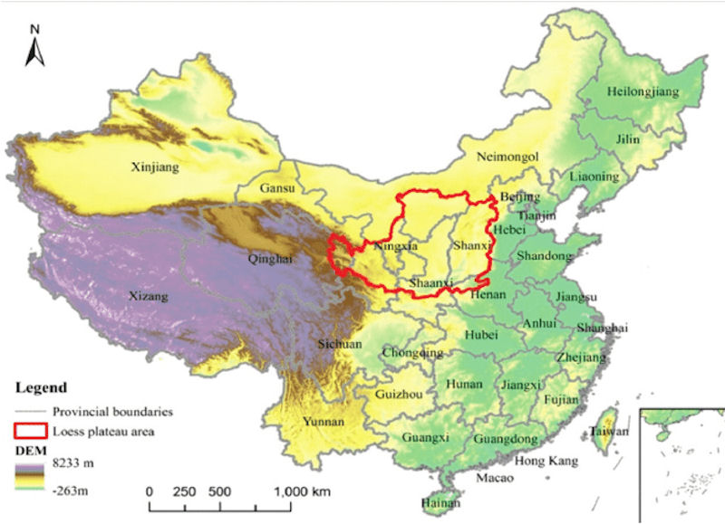 The Loess Plateau is considered the cradle of Chinese civilisation. Approximately the size of France, the plateau is 640,000 kilometers square, situated in the upper and middle reaches of the Yellow River, and stretching over parts of seven provinces. Its name comes from the powdery, mineral-rich, windborne loess soil that characterises the area and which gave the Yellow River its name. Settled agriculture is thought to have emerged 9,500 to 10,000 years ago on the Loess Plateau. Throughout the plateaus long and complex history, human activity produced a great civilisation, while also ecologically destroying the region. It came to be known as the most eroded place on earth.
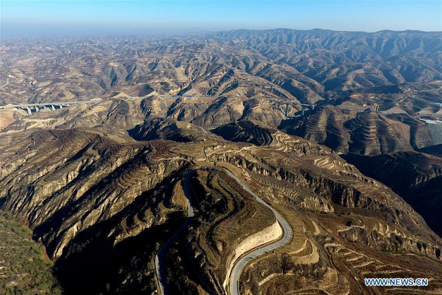
The Loess Plateau is a highland region in north-central China with average elevation about 1,200 meters. It has the thickest known loess deposits in the world. Loess sediments, formed via wind action, are important geological environments. Loess (pronounced "luss"), is German for loose or crumbly. It is a gritty, lightweight, porous material composed of tightly packed grains of quartz, feldspar, mica, and other minerals. The word "loess" is taken directly from German, because loess was first scientifically studied in Germany. In German the word is written Löß, so even the spelling of "loess" has a shaky history. In German, Löß is pronounced in a manner requiring that the tongue and lips be curled into a configuration which no native English speaker can manage without a great deal of practice. The short answer is to pick between pronouncing it like "LERSS," or "LUSS," or like "LOW-ess." Many people pronounce loess the way it's printed -- LOW-ess. But that's like pronouncing the word "island" like "IS-land" or calling Des Moines, Iowa "DEZ-mo-NEZ." However, so many people say LOW-ess that in dictionaries it's often mentioned as an acceptable pronunciation.
Loess are silt-sized particles deposited on the Earth's surface by winds. Extensive loess deposits formed during the Ice Ages in areas bordering large, continental glaciers. Paleosols are past soil horizons preserved in a geologic section, indicative of changes in variables such as temperature and precipitation. These deposits provide some of the most dramatic examples of changes in climate and the effect of processes that shape the landscape. Successive layers are often analyzed to provide a history of long term wind behavior and surface processes.
The Chinese loess plateau stretches from 35°N to 40°N and from 100°E to 115°E and covers an area of 500,000 sq. km. The loess deposits are typically 150 m thick, and they appear to represent continuous deposition of wind-blown, silt-sized material during the past 2.4 million years. The source of this material is believed to be glacial outwash in the regions to the west and north of the plateau (Kukla and An, 1989). More importantly, the loess sequence contains many interbedded paleosols which attest to the existence of significant and cyclic climatic fluctuations. A comprehensive description of the units of the loess sequence is that of Kukla and An (1989), who recognized six stratigraphic units. From youngest to oldest, these are the Holocene Black Loam Formation, the Malan Formation, the Upper Lishi Formation, the Lower Lishi Formation, the Wucheng Formation, and the Pliocene Red Clay.
 Studies in recent decades have revealed that climatic cycles, represented by the loesspalaeosol alternations, are dominated by variations in monsoon circulation over East Asia, which show a coherent variability with respect to global ice-volume cycles. The loess deposits in the Loess Plateau commonly are believed to be derived from deserts west and/or north of the plateau. Thus the Loess Plateau and the deserts can be regarded as a coupled environmental system in terms of a sediment source and sink relationship.
The long, well-exposed and often continuous sequences of loess found throughout the world are generally thought to provide an excellent opportunity for studying long-term, large-scale environmental change during the last few million years. In recent years, the most fruitful loess studies have been those involving the deposits of the loess in China. One of the most intriguing results of that work has been the discovery of an apparent correlation between variations in the magnetic susceptibility of the loess sequence and the oxygen isotope record of the deep sea. This correlation implies that magnetic susceptibility variations are being driven by astronomical parameters. However, the basic data have been interpreted in various ways by different authors, most of whom assumed that the magnetic minerals in the loess have not been affected by postdepositional processes. The loess/paleosol sequences in general, and the Chinese sequences in particular, are considered the best recorders of terrestrial climate change during the last 2.4 million years.
Xixian Loess National Geological Park in Xixian county, Linfen city, in North China's Shanxi province, contains 48 discovered geological relics, including 38 loess landform landscapes. The important geological relics in the park are natural resources for studying the genesis of the Quaternary loess, evolution of paleontology, paleoclimate and paleoenvironment. For example, the Wucheng Loess in the park -- a national-level geological site of the Middle and Lower Pleistocene in the Quaternary strata of China, discovered and named by academicians Liu Dongsheng and Zhang Zonghu in 1962 -- can be used as a benchmark standard section of the loess layer in the middle reaches of the Yellow River. Experts say that in addition, the types of loess landforms in the park are complete and unique, especially the colored loess landforms highlighting the unique charms of the Loess Plateau.
The rehabilitation of the Loess Plateau has significant implications for other places on earth which suffer from large-scale environmental degradation as a result of human impact, and can serve as model for those regions. In the 1990s, the Chinese government decided to restore what took 10,000 years to destroy. Thanks to a complex program of watershed management formulated by the World Bank in cooperation with the Chinese Ministry of Water Resources and the local people an astounding transformation has occurred within just 10 years. Ecological improvements have shown tremendous promise, and local peoples income and quality of life have improved.
|
NEWSLETTER
|
| Join the GlobalSecurity.org mailing list |
|
|
|