

Junggar Basin
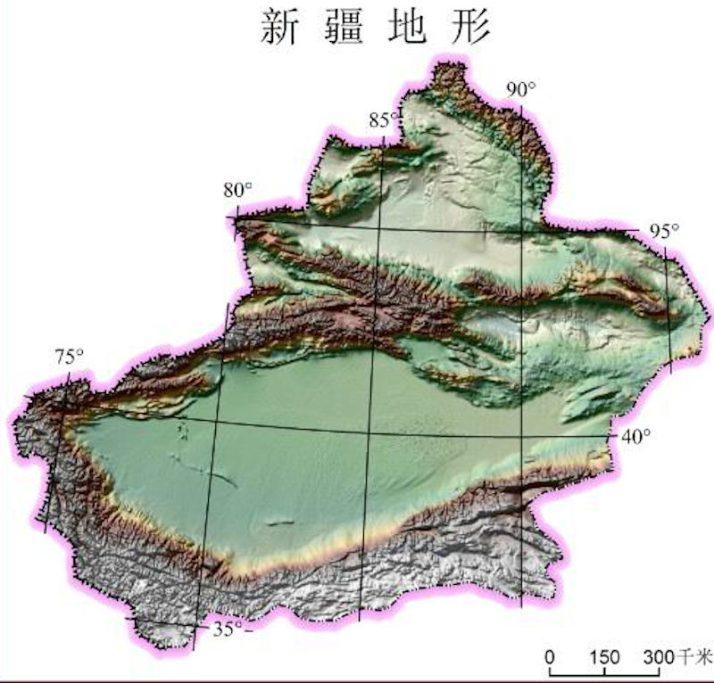
 The Junggar Basin is located between the Altai Mountains and the Tianshan Mountains, with the western Junggar mountains on the west and the foothills of the Beita Mountain on the east. It is 450 kilometers wide from north to south and 700 kilometers from east to west, covering an area of more than 300,000 square kilometers, with desert accounting for 30%. The terrain slopes to the west, and the north is slightly higher than the south. The Ulungu Lake (Brento Sea) in the north has an elevation of 479.1 meters, the Manas Lake in the middle is 270 meters, and the Aibi Lake in the southwest is 189 meters. It is the lowest point in the basin. There are several gaps on the west side of the basin, such as the Irtysh River Valley, Emin River Valley and Alashan Pass. Westerly airflow enters through the gap, bringing precipitation to the basin and surrounding mountains.
The Junggar Basin is an ancient land platform in terms of geological structure. The landform in the basin, the plain can be divided into two regions. From the southern foothills of the Altai Mountains in the north to the northern plains at the northern edge of the desert in the south, wind erosion is obvious, with large wind erosion depressions. The southern plain extends from the northern foot of the Tianshan Mountains in the south to the northern edge of the desert. The Gurbantungut Desert is the second largest desert in China, with fixed and semi-fixed sand dunes dominating, while mobile sand dunes account for only 3%. The annual precipitation in the desert area is about 100 mm, and there is stable snow in winter. The vegetation coverage on the fixed dunes is about 40% to 50%, and about 20% on the semi-fixed dunes. Pasture grows in the depressions between the hills and lacks water in summer. It was once used as a winter pasture. Wells have been drilled at designated locations, and grazing is also possible in summer.
 The basin has a mid-temperate climate. The total annual solar radiation is about 565 kilojoules/square centimeter: the annual sunshine hours are about 3,000 hours in the north and 2,850 hours in the south. The average annual temperature is 3~5°C in the north and west of the basin, and 5~7.5°C in the south. The eastern part of the basin is a cold wave channel. Winter is the coldest place at the same latitude in China. The average temperature of Fuyun in January is -28.7°C. The active accumulated temperature above 10°C is 3 000~3500°C, lasting 150~170 days. The frost-free period is 150~170 days except for 100~135 days in the northeast. The annual average temperature varies by 12 to 14°C per day.
The main natural disasters in the basin are freezing damage and strong winds. About 4 to 5 years, there was a large-scale freezing injury of winter wheat, and a heavier freezing injury of fruit trees in 10 years. Livestock freezing damage mainly occurs in the winter pasture in the center of the basin. In the northern part of the basin, there are 33 to 77 days of strong winds of magnitude 8 or above, 70 days in the west, and 165 days in Alashankou. Due to the large vegetation coverage in the basin, although there are many windy days, the phenomenon of sand dune movement is less than that in the Tarim Basin. However, in some areas, such as Shaquanzi to Toto in the southeast of Lake Aibi, there are 27 crescent-shaped sand dunes. High winds move the sand dunes, blocking traffic and endangering farmland. There are also many sand dunes in the Irtysh River Valley. The winter wind is strong, and stable snow cannot be formed, and it is difficult for spring crops to survive.
 The water vapor in the basin mainly comes from westerly air currents. The west has more precipitation than the east, the edge is more than the center, and the windward slope is more than the leeward slope. There is stable snow cover in the basin in winter, and precipitation in winter and spring accounts for 30% to 45% of the annual total. Except for the Irtysh River, which is an outflow river, all other rivers in the basin are inland rivers, which are based on the low-lying parts of the basin. The river supply mainly comes from the mountains, and the snowmelt water in the spring plains is also supplied. Calculated on the basis of the flow at the river outlet, there is a total annual runoff of 21 billion cubic meters (not including the Yili River and Tacheng Basin rivers), of which the Irtysh River has 10 billion cubic meters of water flowing out of the country. The Irtysh River is the second largest river in Xinjiang, and its tributaries all originate from the southern slope of the Altai Mountains. The inland river of the basin has 4 drainage areas: Wulungu Lake is the end of the Ulungu River. Lake Aibi with Hui Naboltala, Kuitun and Jinghe rivers. Manas Lake with the rivers such as Huinamanas, Jingou, Bayin, and Taxi originated from more than 10 small rivers in the western mountains of Junggar. The Manas River was once the last. Independent water system on the northern slope of Tianshan Mountain. All the rivers from Hutubi to Mulei disappeared into the irrigation area. Due to the diversion of water from the irrigation area, the amount of water entering the lake has drastically reduced.
The replenishment of groundwater in the basin mainly comes from seepage from riverbeds, channels and fields below the mountain pass. From the perspective of the relationship between the supply and demand of agricultural water, there is basically no danger of water shortage.
The main soil in the northern part of the basin is brown calcium soil, and there are chestnut soil, cracked soil, swamp soil, meadow S and saline soil in some areas. The northern zone of the southern part of the basin is dominated by desert calcareous soil, and the southern zone is dominated by brown calcareous soil. There are meadow swamp soil and meadow saline soil at the alluvial fan margin, and salinized desert calcareous soil below the fan margin. Due to limited water sources, it is still difficult to irrigate all the land.
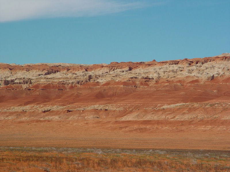
Proved by exploration, the basin has shown promising prospects for oil development. In the wind-eroded depression at an altitude of 540 meters in the eastern part of the basin, more than a thousand silicified woods, which are rare in the world, have been found.
|
NEWSLETTER
|
| Join the GlobalSecurity.org mailing list |
|
|
|