

Martinique - Geography
 Martinique is a popular tourist destination in the Caribbean. It is a volcanic island with northern parts of the island having a wetter, more mountainous and heavily wooded landscape than the south, the region which attracts the majority of tourists. Much of the coastline benefits from the protection of coral reefs, particularly the south and west of the island. Martinique, although an Outermost Region, is a French overseas department (and has been since 1946) and is an integral part of the EU. Martinique is therefore covered by all French and EU rights, regulations and obligations.
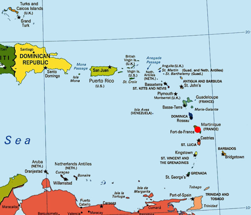
Located in the heart of the Caribbean archipelago, Martinique is one of the Windward islands in the Lesser Antilles group. Its eastern coastline borders the Atlantic Ocean while its western coast is flanked by the Caribbean Sea. The island is 4 350 miles away from France, 1 950 miles from New York and 275 miles from the closest South American coastline. The closest neighboring islands are to the north: Dominica, 16 miles away, Guadeloupe, 75 miles away, and to the south: Saint Lucia, 23 miles away. Martinique is equidistant from the coasts of Venezuela and Haiti/Dominican Republic (497 miles).
Martiniques eastern coastline borders the Atlantic Ocean while its western coast is flanked by the Caribbean Sea. The island is 4,350 miles away from France, 1,950 miles from New York, and 275 miles from the closest South American coastline. At its greatest points, Martinique measures 50 miles long and 24 miles wide, delivering 425 square miles of rugged mountainous landscape, dense forests, rivers, waterfalls, rolling hills, and most importantly many picturesque bays and coves.
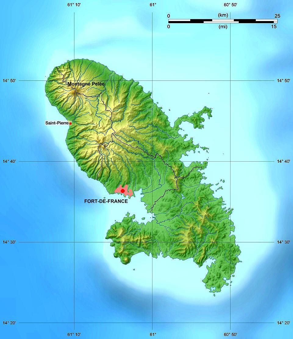
The island covers 1,128 km², it counts as one of the smallest French departments. Martinique is in the archipelago of Lesser Antilles, a volcanic zone at the crossing of several tectonic plates. Its peak is Mount Pelee, a volcano still active and among the most closely watched in the world, which rises to 1,397m above sea level. The rest of the island consists of a succession of medium reliefs, the hills, the highest reaches 505m, the mountain of Vauclin. The northern part of Martinique features dense rain forest, mountain peaks, a volcano and dark sand beaches. The southern areas are much drier and flatter with magnificent white sand beaches.
The incredible beaches of Martinique come in many different varieties. On the west coast, there are numerous white sand beaches south of Fort-de-France, while the northern beaches (such as those at Carbet and St. Pierre) are darker due to their volcanic origins. On the eastern / Atlantic coast, the coastline tends to be more rugged except on the Caravelle Peninsula and at Anse Azérot, Cap Macré and Grande Anse Macabou where the waters are usually calm and inviting.
The famous Plage des Salines is in the south, a short drive from Ste. Anne, with tall coconut palms and a mile of dazzling white sand. During the summer holidays and weekends, it is often busy with families and children; during the week, it is usually quiet and less crowded. Other lovely Martinique beaches in the south include those at Ste. Anne, Ste. Luce, Cap Chevalier, Le Diamant (with the famous Diamond Rock offshore) and Anses d'Arlets.


|
NEWSLETTER
|
| Join the GlobalSecurity.org mailing list |
|
|
|