


Ras Koh
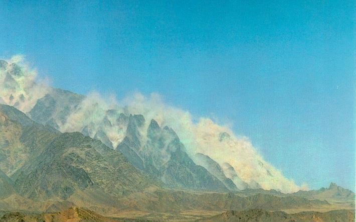 On 28 May 1998 Pakistan announced that it had conducted five (simultaneous) nuclear weapons tests, in response to the same number of nuclear tests by India. Only one detonation was detected by seismic monitoring stations. The preliminary source parameters of this event determined by the IDC (International Data Center) were as follows: ORIGIN TIME: 10:16:25.7 EPICENTER: 29.06N 64.82E. Subsequent analysis disclosed that the test was actually conducted in a horizontal shaft in Ras Koh [literally, "gate of the mountains", or "foothill"] mountain, some distance to the southwest of the seismic location.
The photograph of the Ras Koh test site was released a week after the test. Prime minister Sharif and Information Minister Syed Mushahid Hussain took two separate groups of journalists to the Ras Koh test site, at which point it was disclosed that the sixth test had been conducted elsewhere, in the Kharan desert.
A structural depression separates the Chagai Hills and the Ras Koh Range to the south, consisting of flood plains and areas covered with thin layers of salt. Outside the monsoon zone, Balochistan receives scanty and irregular rainfall (4 inches); the temperature is very high in summer and very low in winter. Apart from the Toba Kakar Range, which has scattered juniper, tamarisk and pistachio trees, the other ranges are largely devoid of vegetation. Most of the people, therefore, lead nomadic life, raising camels, sheep and goats.
| # | JDATE | ORIGIN TIME | LAT | LON | MB | YIELD | YMAX | EVNAME | AUTHOR | EVID | WF |
|---|---|---|---|---|---|---|---|---|---|---|---|
| 1 | 1998148 | 05/28/98 10:16:15.8 | 28.950N | 64.720E | 4.9 | - | - | - | PDE-Q | 1440562 | 1570 |
Photographic Evaluation Report
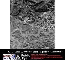
High resolution imagery is available from two sources, including declassified CORONA imagery which would provide negation. As of 04 June 2000 a Terraserver 25 February 1998 Russian 2-meter resolution KVR-1000 image covering this area was available via the SPIN-2 service on TerraServer. As of 04 June 2000 archival Space Imaging IKONOS 1-meter imagery available on the CARTERRAT Archive did not include any coverage of the Ros Koh test area.
| Click on the small image to view a larger version | ||
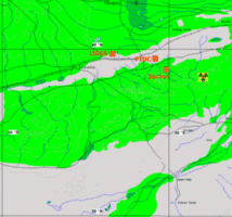
Seismic and imagery locations |
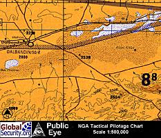 Tactical Pilotage Chart of Ras Koh and surrounding area. (Source: National Geospatial and Intelligence Agency) |
|
 10-meter GSD |
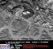 5-meter GSD |
|
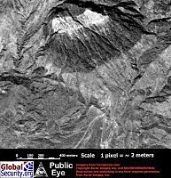 2-meter GSD |
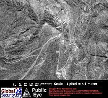 1-meter GSD |
|
|
NEWSLETTER
|
| Join the GlobalSecurity.org mailing list |
|
|
|