Wazir Khan Khosa
Kharan Desert
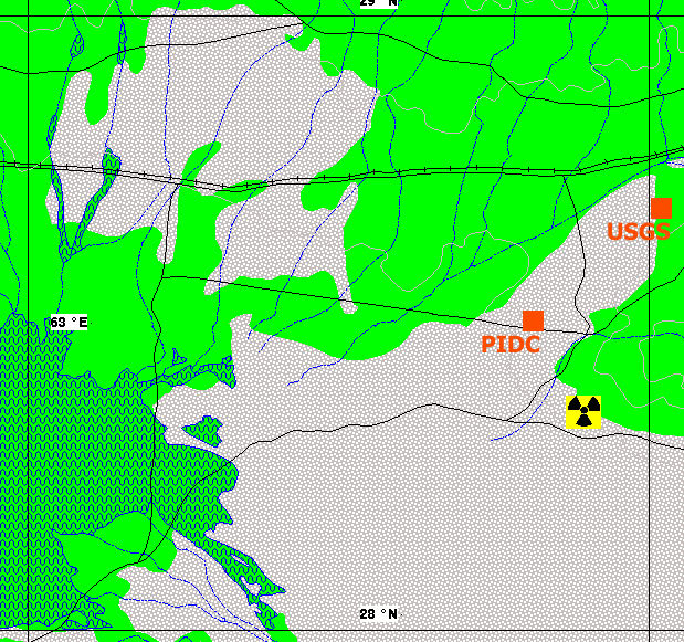
Two sets of coordinates for the test location are available from different sources: the CTBT Prototype International Data Center [PIDC]; the US Geological Survey; and from satellite imagery that covers the actual test site as identified through imagery analysis and collateral information. In four of the five cases, the estimated seismic location was found to be to the northwest of the actual location as determined using satellite imagery. It is evidently the case that seismic monitoring can locate detectable underground nuclear weapons tests with an accuracy of a few dozen kilometers.
30 May 1998
SEISMIC
PIDC 28.494N 63.781E
USGS 28.720N 64.020E
average 28.607N 63.900E
IMAGERY 28.350N 63.869E
bias
PIDC 18 km
USGS 34 km
average 28 km
Vector Map Level 0 chart of the Kharan desert and surrounding area. (source: National Geospatial Agency
|
|
|
|
NEWSLETTER
|
|
Join the GlobalSecurity.org mailing list
|
|
|


