|
Credit: spaceimaging.com. Copyright (c) Space Imaging. ALL RIGHTS RESERVED. Online and news media distribution or publishing requires permission from Space Imaging.
|
| Click on the small image to view a larger version |
 CIA Map of East Asia centered on North Korea
|
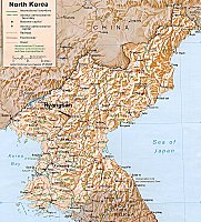
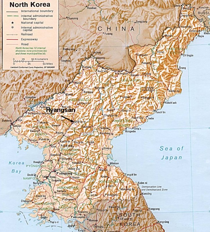
CIA Map of North Korea, depicting the town of Hyangsan, near the suspect UGF
|
|
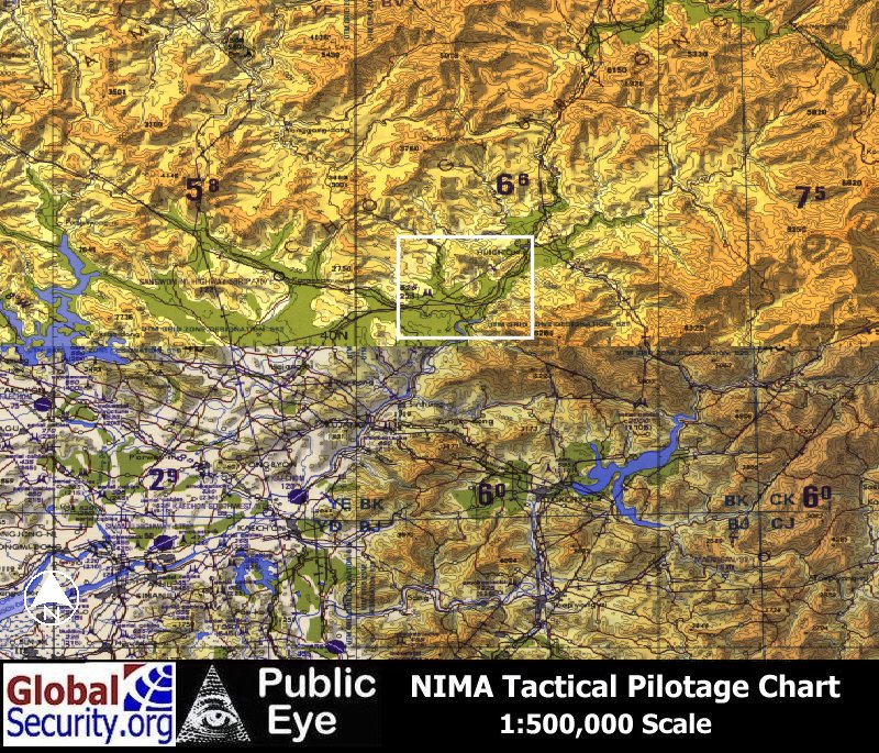
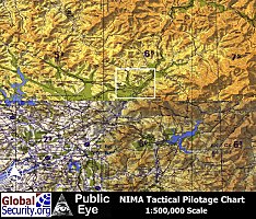 Tactical Pilotage Chart of P'Yongan Namdo region of North Korea
|
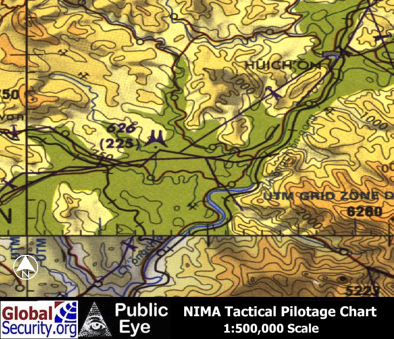
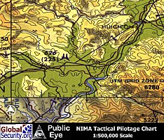 Myohyang Mountains and surrounding area
|
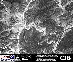
 CIB imagery of the Myohyang Mountain area
|
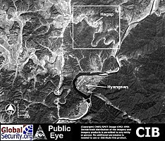
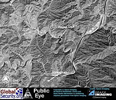
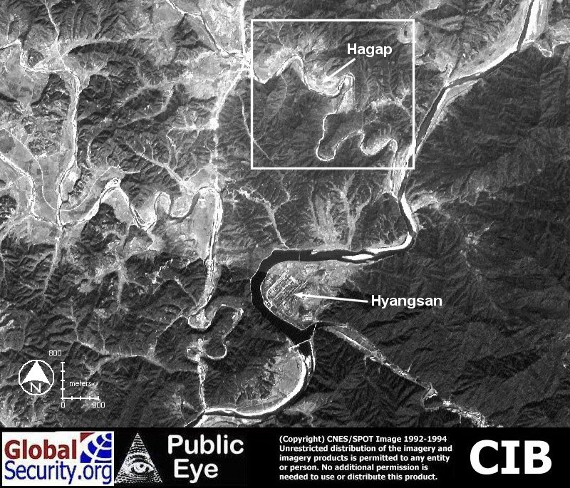
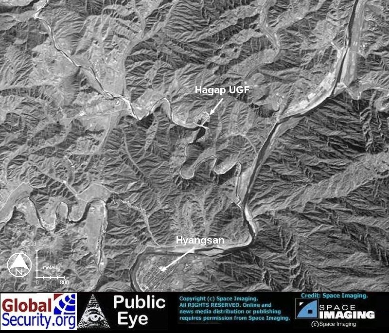
 CIB imagery of the area surrounding the village of Hagap and the Underground facility (UGF)
|
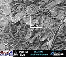
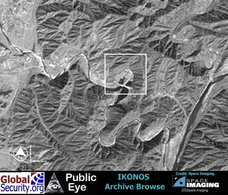
 Ikonos browse imagery overview of the region around the village of Hagap and the UGF.
|
 Ikonos browse imagery of the area around the village of Hagap and the UGF.
|
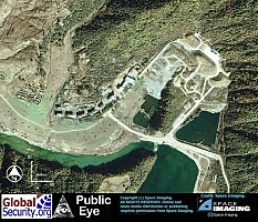
 Ikonos imagery of the village of Hagap and the Undeground Facility as of 18 October 2000.
|
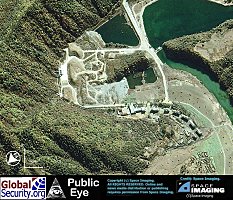
 Ikonos imagery of the village of Hagap and the Undeground Facility as of 18 October 2000.
|
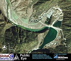
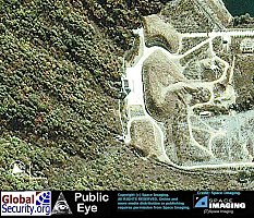
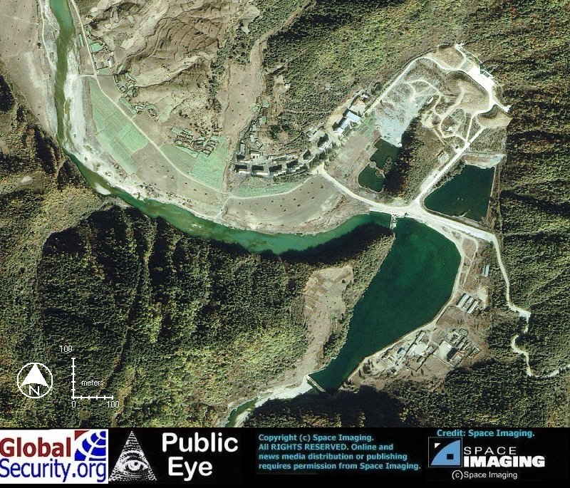
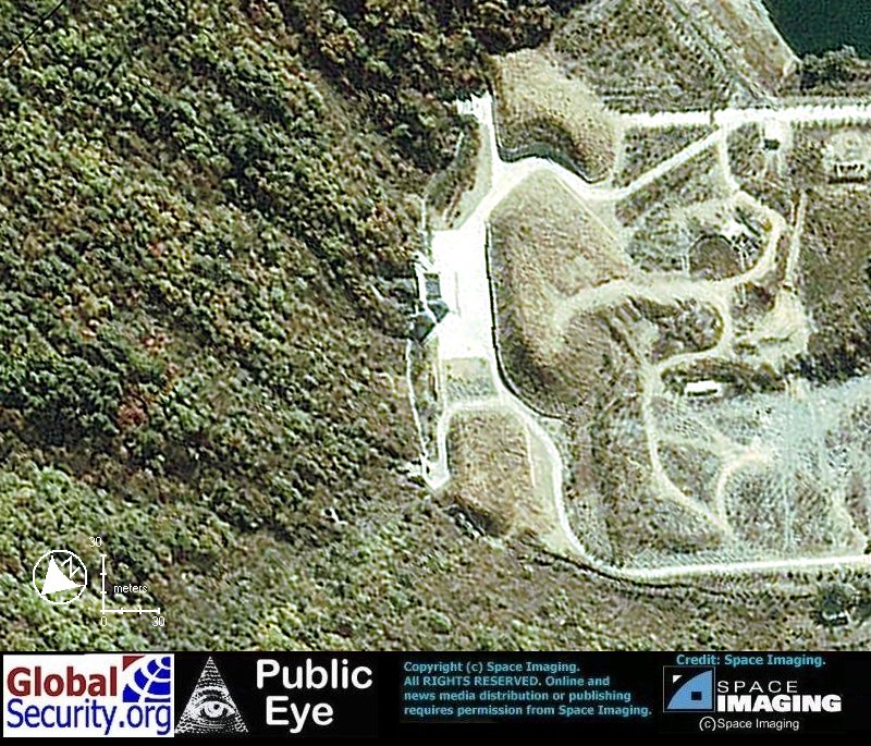
 the Hagap Undeground Facility. Situated at the base of a mountain, three tunnel entrances provide accesss to a facility of unknown size and function.
|
 Close-up of the three tunnel entrances.
|
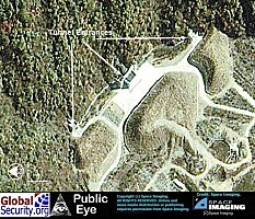 The two smaller entrances on each side of the main entrance measure 7 meters in width. The main entrance measures approximately 10-15 meters in width.
|
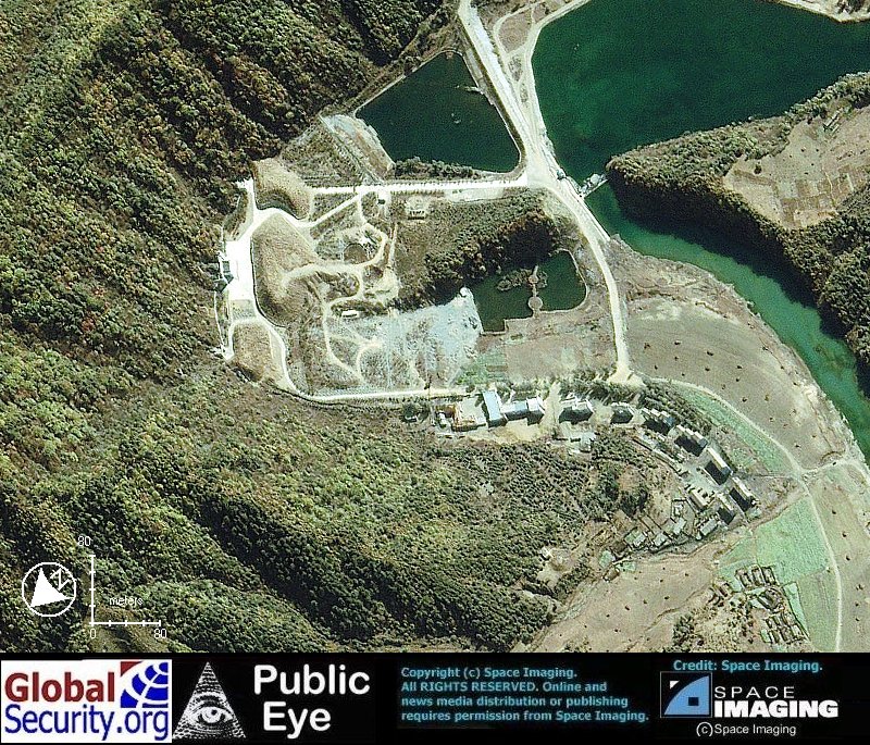
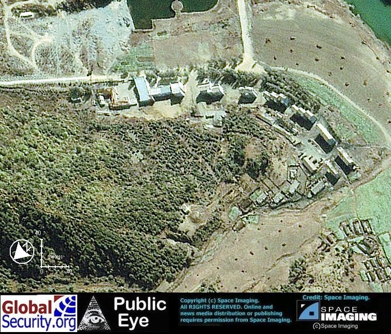
 Above ground support buildings associated with the undeground facility.
|


 CIA Map of East Asia centered on North Korea
 Tactical Pilotage Chart of P'Yongan Namdo region of North Korea
 Myohyang Mountains and surrounding area
 CIB imagery of the Myohyang Mountain area
 CIB imagery of the area surrounding the village of Hagap and the Underground facility (UGF)
 Ikonos browse imagery overview of the region around the village of Hagap and the UGF.
 Ikonos browse imagery of the area around the village of Hagap and the UGF.
 Ikonos imagery of the village of Hagap and the Undeground Facility as of 18 October 2000.
 Ikonos imagery of the village of Hagap and the Undeground Facility as of 18 October 2000.
 the Hagap Undeground Facility. Situated at the base of a mountain, three tunnel entrances provide accesss to a facility of unknown size and function.
 Close-up of the three tunnel entrances.
 The two smaller entrances on each side of the main entrance measure 7 meters in width. The main entrance measures approximately 10-15 meters in width.
 Above ground support buildings associated with the undeground facility.