


LIST OF FIGURES
-
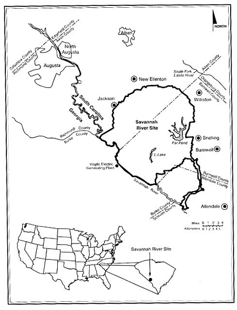
1-1 Location of the Savannah River Site
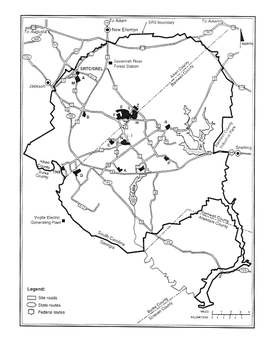
1-2 Locations of principal industrial areas at the Savannah River Site
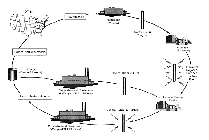
1-3 Historic nuclear materials production cycle at the Savannah River Site
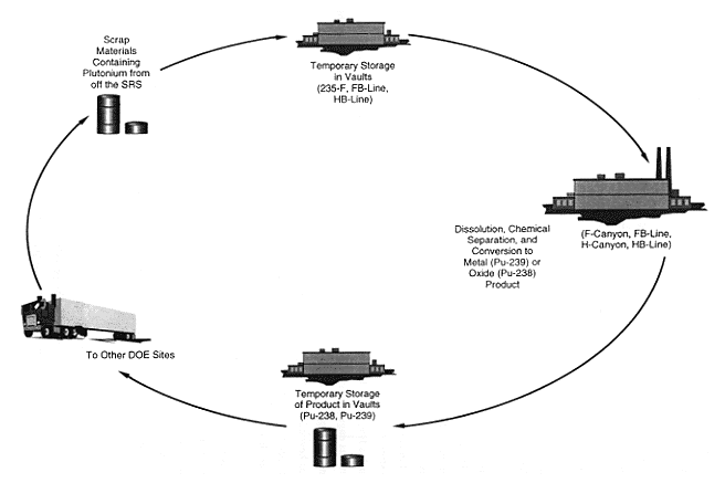
1-4 Historic scrap recovery cycle for plutonium at the Savannah River Site
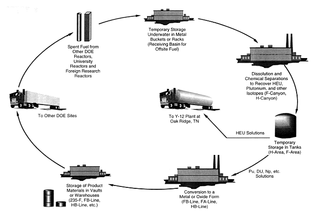
1-5 Historic reprocessing cycle for offsite spent fuel at the Savannah River Site
1-6 Amount of nuclear material in each category
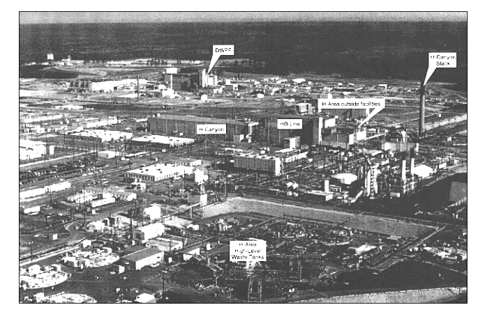
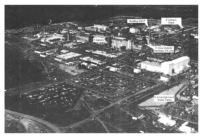
2-2 F-Area
3-1 Representative site for Dry Storage Facility
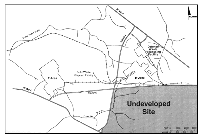
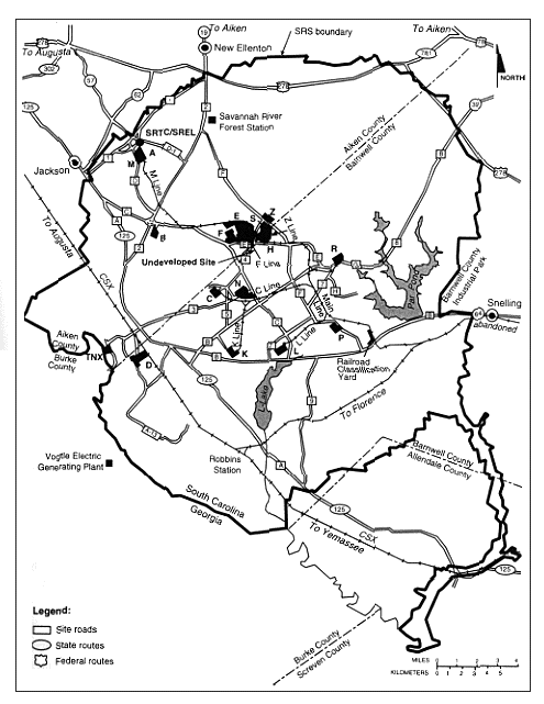
3-2 Savannah River Site, showing principal industrial areas, roads, and railroads
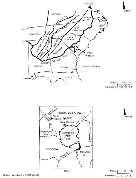
3-3 General location of the Savannah River Site and relationship to physiographic provinces of the eastern United States
3-4 Savannah River Site, showing seismic fault lines and locations of onsite earthquakes
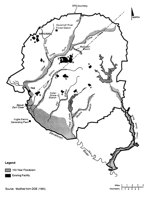
3-5 Savannah River Site, showing 100-year floodplain and major stream systems
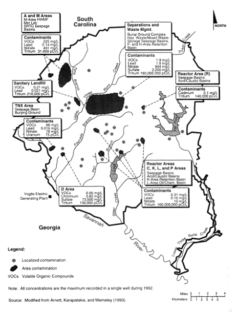
3-6 Groundwater contamination at the Savannah River Site
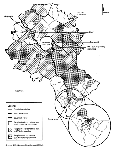
3-7 Distribution of people of color by census tracts in the SRS region of analysis
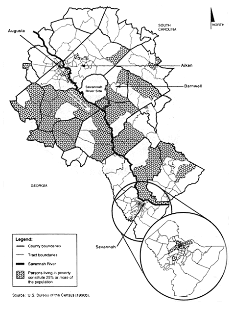
3-8 Low-income census tracts in the SRS region of analysis
3-9 Major sources of radiation exposure in the vicinity of the Savannah River Site
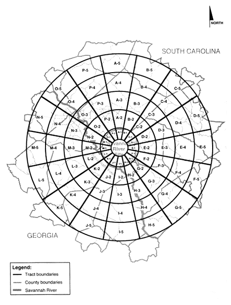
4-1 Annular sectors around the Savannah River Site
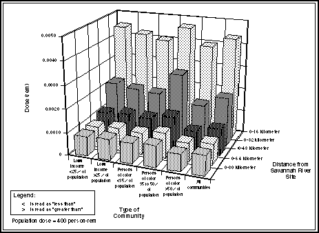
4-2 Community impacts from Comparative Alternatives Scenario
|
NEWSLETTER
|
| Join the GlobalSecurity.org mailing list |
|
|
|