

Bougainville - Geography
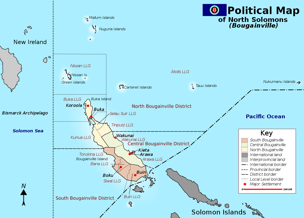
 The Autonomous Region of Bougainville (formerly known as the Northern Solomons Province) is comprised of two main islands, Bougainville Island and Buka Island, and many small islands and atolls. In total, the regions terrestrial area covers approximately 9,384km2. The region is organised into three sub-districts; North, Central and South. The landscape is a mix of coastal and mountainous areas with the highest feature, Mount Balbi, reaching 2,715m above sea level.
Bougainville is what Yash Ghai and Anthony Regan describe as a reluctant part of PNG.10 It is the remotest of PNGs provinces, located over 900 kilometres from the mainland. From a cultural, linguistic and geographic perspective, Bougainville sits within the Solomon Islands archipelago. It became part of PNG in one of the accidents of late-19th century colonial map-drawing. German and British colonial boundaries were reinforced when Australia administered the combined territories of Papua and New Guinea following World War II, and then cemented when PNG gained independence from Australia in 1975. But the result was an uncomfortable fit and gave rise, for some Bougainvilleans, to secessionist dreams.
Bougainville consists of three main political regionsnorth, central and south Bougainville. These regions span two main islands, Buka and Bougainville, as well as a scattering of outlying atolls.
The region experiences earthquakes and is vulnerable to tsunamis on its coastal areas. Bougainville Island also has a number of active volcanoes. The region does not experience tropical cyclones but in the event of strong rainfall river crossings and bridges are prone to flooding.


|
NEWSLETTER
|
| Join the GlobalSecurity.org mailing list |
|
|
|