


Al Kufah, Iraq
| Imagery of Al Kufah |
||
| Click on the small image to view a larger version | ||
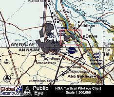 TPC map of the cities of Najaf and Kufah (Source: NGA)
|
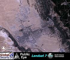 Landsat imagery of Najaf and Kufah (Source: ESDI University of Maryland)
|
|
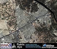 Overview of Kufah and the neighborhoods of Al Kindah, Al Hayliyah, and Al Jihad as of 24 August 2001(Source: Space Imaging Eurasia)
|
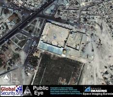
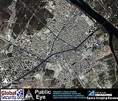 Overview of the central part of Kufah. (Source: Space Imaging Eurasia)
|
|
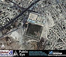
 The Baath Party District Headquarters complex in Kufah as of 24 August 2001. (Source: Space Imaging Eurasia)
|
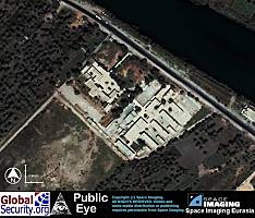 An unidentified former Iraqi government complex. (Source: Space Imaging Eurasia)
|
|
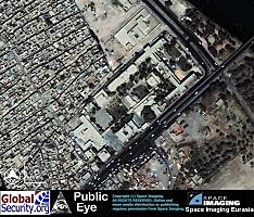
 Overview of the Great Mosque of Kufah and ruins.(Source: Space Imaging Eurasia)
|
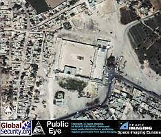
 Detail of the Great Mosque. (Source: Space Imaging Eurasia)
|
|
 The Imam Sahlah Mosque in the northern part of Kufah. (Source: Space Imaging Eurasia)
|
||
|
NEWSLETTER
|
| Join the GlobalSecurity.org mailing list |
|
|
|