
Asian Tsunami Imagery
Aceh, Sumatra, Indonesia
The imagery below was taken by the DigitalGlobe satellite. The image shows agricultural fields, houses, and a mosque. In the wake of the tsunami, all the agricultural fields have been washed away. Most of the vegetation, including trees have been also been affected while all the houses have been destroyed. Only the mosque has been left standing. The pre-tsunami image was taken on 12 April 2004. The post-tsunami image was taken on 02 January 2005.
| Andaman Tsunami - Aceh, Sumatra, Indonesia. Pre- and Post-Tsunami Comparison | Toggle mouse over and off image for comparison |
|
|
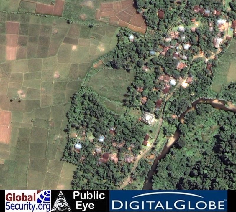 Pre- and Post-Tsunami comparitive magery overview of a tsunami-affected area of Aceh, Sumatra, Indonesia.
(Image source: DigitalGlobe) |
|
NEWSLETTER
|
| Join the GlobalSecurity.org mailing list |
|
|
|