

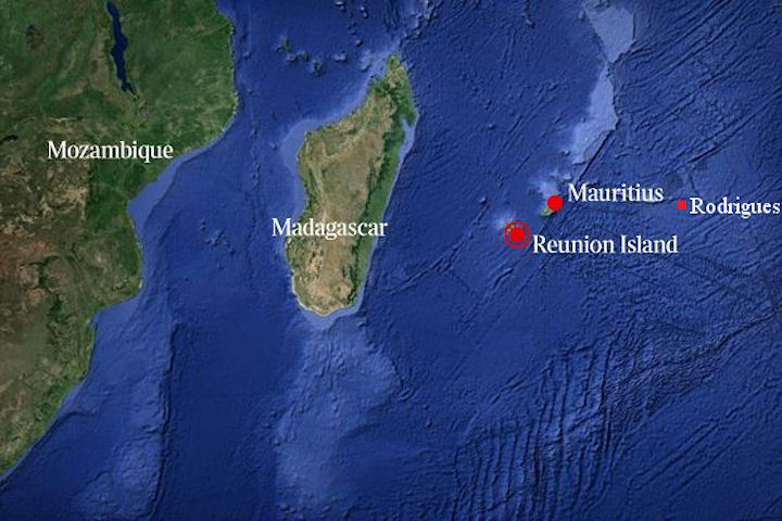
Reunion - Geography
 Covering a total area of 2,512 square kilometers, the island is bordered by 210 kilometers of inhospitable coastline, except for 25 kilometers of white sand beach and 14 km of black sand, West. It offers practically no natural shelter for navigation, except the bay of St. Paul.
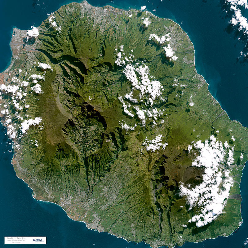
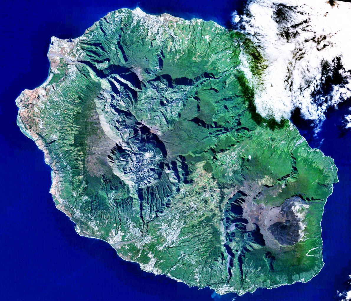
It is made up of two volcanic assemblages. In the north-western part, Piton des Neiges (3,069 meters) dominates the three circuses of Cilaos, Salazie and Mafate which enclose it. The latter, where 700 inhabitants live, is inaccessible by car. They are the result of the collapse and erosion of the flanks of the ancient volcano. To the south-east, Piton de la Fournaise (2,631m) is an active volcano of the Hawaiian type. It is a particularly active volcano, which erupts about three times a year, which is still a popular sight of the Reunion Islanders. La Plaine des Cafres and the Plain des Palmistes, which join the Col de Bellevue, provide the link between the two massifs of Piton des Neiges and Piton de la Fournaise.
The configuration of the island, which was subject to heavy rains during the humid tropical climate season (between 2,600 and 4,000mm in the east from November to April), resulted in the formation of countless "gullies" or "rivers ", Which descend from the summits alternating steep gorges and calmer areas, cluttered with rocks and sometimes adorned with waterfalls and" basins ". The erosion in Réunion is one of the strongest recorded in the world, it is irreversible and structures the landscapes and the typical relief of the island.
The eastern coast of the island, known as the "coast to the wind", is very watered, where several rivers, such as the Mât, Marsouins and the East, are perennial, contrasted with the west coast, "leeward" Arid lands.
Reunion's vegetation, which has many endemic species, varies according to altitude and climate: tropical forest or dry savannah, sugarcane plantations or fruit trees. If the forest is home to extraordinary tree ferns, it is also rich in multicolored birds.
The area of Pitons, cirques and remparts of Reunion Island coincides with the core zone of La Réunion National Park. The property covers more than 100,000 ha or 40 % of La Réunion, an island comprised of two adjoining volcanic massifs located in the south-west of the Indian Ocean. Dominated by two towering volcanic peaks, massive walls and three cliff-rimmed cirques, the property includes a great variety of rugged terrain and impressive escarpments, forested gorges and basins creating a visually striking landscape.
The property harbors the most valuable natural habitats and the species assemblages they support remaining on the Mascarene Island group. It protects key parts of a recognized global centre of plant diversity and features a remarkably high level of endemism across many taxa. Thereby, Pitons, cirques and remparts of Reunion Island is the most significant and important contribution to the conservation of the terrestrial biodiversity of the Mascarene Islands.
The combination of volcanism, tectonic landslide events, heavy rainfall and stream erosion have formed a rugged and dramatic landscape of striking beauty, dominated by two towering volcanoes, the dormant Piton de Neiges and the highly active Piton de la Fournaise. Other major landscape features include "Remparts" - steep rock walls of varying geological age and character, and so-called "cirques", which can be described as massive natural amphitheatres with an imposing height and verticality. There are deep, partly forested gorges and escarpments, with subtropical rainforests, cloud forests and heaths creating a remarkable and visually appealing mosaic of ecosystems and landscape features.
The reef formations around the Reunion Island are not highly developed; nonetheless, they play an important natural protective role in the face of heavy ocean swell and tropical storms, especially in the town of Saint-Pierre. Situated to the west of the island, they form a broken band some 25 kilometers long (or just 8% of the islands perimeter), for a total area of 12 km². Seats of remarkable biodiversity, the coral reefs of Reunion also constitute remarkable natural, landscape and cultural patrimonies which contribute to the well being of the population of Reunion and the occasional visitors. However, since the late 1970s, these natural environments have been damaged and even in some sectors, which have been severely degraded. This degradation is linked to global climate changes but also to certain local human activities which can have a significant impact on the balance of the reef. For this reason, a Marine Nature Reserve was created in 2007, covering 40 km of coastline on the western coast of the island, whose objective is to ensure the preservation of the marine natural heritage of the island. Meeting. The surface of this reserve is 35km².


|
NEWSLETTER
|
| Join the GlobalSecurity.org mailing list |
|
|
|