

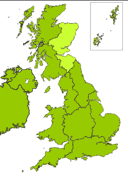
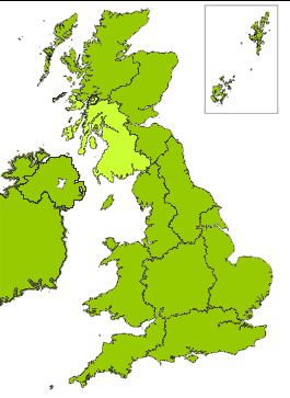
Scotland - Climate
Scotlands climate varies greatly between regions, with some regions for example, the western Highlands home to wet and windy weather due to the winds which come in from the Atlantic Ocean. In contrast, the eastern side of the country, including Aberdeenshire, Fife and the Lothians, sees the same or less rainfall annually than many major cities around the world, including New York, Rome, Morocco and Barcelona.
The countrys high latitude means that winter days are short and summer days are long. Summer months in Scotland bring days with extended twilight, and in the far north of Scotland, days with no complete darkness. The northernmost parts of the country enjoy up to four hours more daylight than London during summer. July and August are usually Scotlands warmest months, with temperatures averaging 20°C.
During the winter, Scotland often has more snowfall than more southern regions of the UK. On average, snow falls in Scotland on 15 to 20 days per year, though in the mountains in the Highlands this number rises to 100. Scotlands coldest months are January and February, when maximum daytime temperatures average between 5° and 7°C.
Rainfall is caused by the condensation of the water in air that is being lifted and cooled to its dew point. Rainfall tends to be associated with Atlantic depressions or with convection. The Atlantic Lows are more vigorous in autumn and early winter and bring most of the rain that falls in these seasons. In summer, convection caused by solar surface heating sometimes forms shower clouds. A further factor that greatly affects the rainfall distribution is altitude. Moist air that is forced to ascend hills may be cooled to the dew point to produce cloud and rain. A map of average annual rainfall therefore looks similar to a topographic map.
The number of hours of bright sunshine is controlled by the length of day and by cloudiness. In general, December is the dullest month and May or June the sunniest. Sunshine duration decreases with increasing altitude, increasing latitude and distance from the coast. Local topography also exerts a strong influence and in the winter deep glens and north-facing slopes can be in shade for long periods.
 Much of Northern Scotland is exposed to the rain-bearing westerly winds, particularly the Western Isles and the west coast. As a result, most of the western half of the region has an average annual rainfall of at least 1700 mm. The highest average annual rainfalls occur over the higher, west-facing slopes, with the wettest area being to the northwest of Fort William (over 4000 mm per year). Over the lower lying islands the average is less than about 1600 mm whilst near the Moray Firth, to the lee of the mountains, it is only about 700 mm. These values can be compared with annual totals around 500 mm in the driest parts of eastern England.
Rainfall is generally well-distributed throughout the year. The frequency of Atlantic depressions is normally greatest during the autumn and winter but, unlike other parts of the UK, Scotland tends to remain under their influence for much of the summer too. In the western and northern areas there is an autumn/early winter maximum, whereas places close to the Moray Firth tend to have a more even distribution through the year. Late spring and early summer is normally the driest part of the year.
On average, the number of days with snow falling varies from less than 30 per year along the west coast to over 100 days over the Grampians. The number of days with snow lying has a similar distribution, with less than 6 over the westernmost islands, about 20 in Shetland and more than 50 days over the higher ground. On the highest summits, such as Ben Nevis, snow cover typically persists for 6 or 7 months each year. The relatively plentiful supply of snow over the highest ground has led to the development of skiing areas such as Glencoe and the Nevis Range (Aonach Mor), both near Fort William, and the Cairngorms near Aviemore.
Mean annual temperatures over the region at low altitude vary from about 9 °C close to the Moray Firth and on the westernmost isles to about 7 °C on Shetland, but over the higher ground temperatures are generally lower so that at Cairngorm Summit the annual mean is just below 1 °C. Elsewhere in the UK, mean annual temperatures reach over 11 °C in Cornwall and the Channel Islands. Within the region, significant variations in temperature arise from the combined effects of proximity to the coast and topography.
Temperature shows both a seasonal and a diurnal variation. Minimum temperatures usually occur around sunrise and maximum temperatures are normally 2 to 3 hours after midday.
January or February is the coldest month, with mean daily minimum temperatures varying from about 2 °C on west-facing coasts and in the Western and Northern Isles, to less than -1 °C over higher ground. Extreme minimum temperatures can occur in winter; examples include -27.2 °C at Altnaharra (Highland) on 30 December 1995 (the UK record low temperature, shared with Braemar, Grampian). Conversely, occasionally to the lee of high ground temperatures can reach up to 15 °C in winter when a south or SW airstream warms up after crossing upland - an effect known as a fohn wind.
July or August is the warmest month, with mean daily maximum temperatures at low levels around 19 °C in areas close to the Moray Firth. Elsewhere in northern Scotland the mean daily maxima are somewhat lower, and are less than 16 °C over the higher ground and the islands. Extreme maximum temperatures can occur in July or August, and are usually associated with heat-waves. On the larger Western Isles and in sheltered places, temperatures can exceed 28 °C. For example, 32.1 °C was recorded at Onich (Highland) on 1 August 1995. In contrast, over Shetland high maxima are not achieved and the record is only 25 °C, set at Baltasound on 2 July 1958.
 Much of Eastern Scotland is sheltered from the rain-bearing westerly winds. This shelter reaches its greatest potential along the coasts of East Lothian, Fife and the Moray Firth and these areas receive less than 700 mm of rainfall in an average year. In contrast, the wettest area is the southern Grampians where the average annual rainfall is over 1500 mm. These values can be compared with annual totals around 500 mm in the driest parts of eastern England and over 4000 mm in the western Scottish Highlands. Rainfall is generally well-distributed throughout the year.
The climate of Eastern Scotland features mean annual temperatures over the region vary from about 9 °C close to the Firth of Forth to less than 6 °C over the higher ground of the Grampians. Elsewhere in the UK, mean annual temperatures reach over 11 °C in Cornwall and the Channel Islands. Within the region, significant variations in temperature arise from the combined effects of proximity to the coast, topography and, to a lesser extent, urban development. Temperature shows both a seasonal and a diurnal variation. Minimum temperatures usually occur around sunrise and maximum temperatures are normally 2 to 3 hours after midday.
January is the coldest month, with mean daily minimum temperatures varying from about 2 °C in areas of East Lothian and Fife bordering the Firth of Forth and on the NE coast of Grampian, to less than -2 °C over the higher ground. Extreme minimum temperatures usually occur in January or February. Examples include the UK record low temperature of -27.2 °C at Braemar (Grampian) on 10 January 1982 (a record shared with Altnaharra, Highland). This occurred during a severe cold spell across Scotland with some night minima below -15 °C and day maxima below -5 °C on several days. Conversely, to the lee of high ground temperatures can occasionally reach up to 15 °C in winter when a south or SW airstream warms up after crossing upland - an effect known as a fohn wind.
July is the warmest month, with mean daily maximum temperatures at low levels inland approaching 20 °C, the highest in Scotland. Elsewhere in Eastern Scotland the mean maxima are somewhat lower, and are less than 17 °C over the higher ground and along the coast of Grampian region. Extreme maximum temperatures can occur in July or August, and are usually associated with heat-waves. Examples include 30.8 °C at Leuchars (Fife) on 2 August 1990, 31.4 °C at Edinburgh airport on 4 August 1975 and the Scottish record temperature of 32.9 °C at Greycrook (Borders) on 9 August 2003.
 The climate of Western Scotland is milder than that of Eastern Scotland due to the stronger maritime influence, as the prevailing winds blow from the sea. The warm Gulf Stream also has a strong influence on Western Scotland. With winds mainly blowing from the sea the annual mean temperatures are in the range 9.5 to 9.9 °C in coastal areas such as Ayrshire, Bute and Kintyre. This mean temperature is also reached in central Glasgow, due to the urban heat island effect. The annual mean temperature tends to fall towards the south and north parts of the region due to altitude, as well as inland where 8.0 to 9.4 °C is more typical. The lowest annual mean temperature for low lying areas in the UK is about 7 °C in the Shetlands.
The strong maritime control of temperature is best seen in the annual temperature range, the difference between the mean temperature of the warmest and coldest months. The smaller the temperature range, the greater the maritime influence. In parts of Galloway, Kintyre and the Hebrides the annual temperature range is about 9 °C, which is similar to that found in western Ireland; for comparison the annual temperature range increases to about 14 °C in the English Midlands as the maritime influence decreases.
The sea reaches its lowest temperature in February or early March so that on average February is the coldest month in some coastal parts of Ayrshire, the Rinns of Galloway, Kintyre and the Hebrides. In February the mean daily minimum temperature varies from about 2 °C in most of the islands, 1 to 2°C along most of the Solway Firth and lowland inland areas, but less than -1 °C in parts of the Southern Uplands and central Highlands. Inland, where the influence of the sea is less, January is the coldest month with mean daily minimum temperatures generally between -3 and 0 °C.
|
NEWSLETTER
|
| Join the GlobalSecurity.org mailing list |
|
|
|