


Tiahe Airbase
This isolated airbase, which is located near no population center, is almost certainly a military airbase.
Photographic Evaluation Report
High resolution imagery is only available from declassified CORONA imagery. As of 01 May 2000 Russian 2-meter resolution KVR-1000 imagery coverage was not available via the SPIN-2 service on TerraServer, nor was archival Space Imaging IKONOS 1-meter imagery available on the CARTERRAT Archive.
| Tiahe Airbase | ||
| Click on the small image to view a larger version | ||
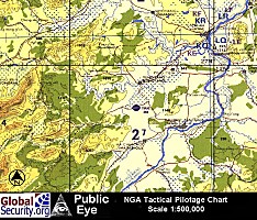 NGA Tactical Pilotage Chart of Tiahe Airbase and surrounding area. (Source: National Geospatial-Intelligence Agency) |
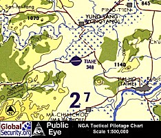 NGA Tactical Pilotage Chart of Tiahe (Source: National Geospatial-Intelligence Agency) |
|
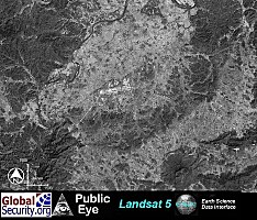 Landsat-5 image of Tiahe as of Nov. 09, 1994. (Source: Earth Science Data Interface, University of Maryland) |
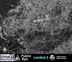 Tiahe Airbase as of Nov. 09, 1994. (Source: ESDI) |
|
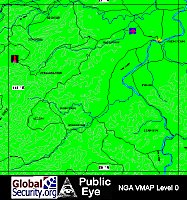 NGA VMAP of Tiahe Airbase and surrounding area. (Source: National Geospatial-Intelligence Agency) |
||
|
NEWSLETTER
|
| Join the GlobalSecurity.org mailing list |
|
|
|