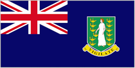
British Virgin Islands - Geography
 The British Virgin Islands - about 60 islands, cays, and rocks - are located in the Caribbean, between the Caribbean Sea and the North Atlantic Ocean, east of Puerto Rico. Its geographic coordinates are 18°30'N 64°30'W. Map references include Central America and the Caribbean. The area comprises 16 inhabited and more than 20 uninhabited islands; includes the islands of Tortola, Anegada, Virgin Gorda and Jost van Dyke.
The Virgin Islands is comprised of and has a total land area of 151-154 square kilometers (59 square miles - about 0.9 times the size of Washington, DC). The main islands include Tortola (54 square kilometers / 21 square miles), Anegada (39 square kilometers / 15 square miles), Virgin Gorda (21 square kilometers / 8 square miles), and Jost Van Dyke (9 square kilometers / 3.4 square miles).
The territorial sea of The Virgin Islands covers a much larger area of 1,489 square kilometers (575 square miles) and extends 5.6 kilometers (3.5 miles) from the low water line. The Exclusive Economic Zone (EEZ) extends 322 kilometrrs (200 miles) north and northeast and up to 80 kilometers (50 miles) southeast from the islands’ coasts.
The islands (with the exception of Anegada, a very flat limestone island) were part of a submerged mountain range created through volcanic activity and were formed into the islands they are today through a series of tectonic processes, sea level changes, and erosion. The islands therefore, are dominated by a series of steep-sloping hills punctuated by deep valleys in which there are drainage channels known locally as “ghuts.” There is a relative scarcity of flat land, all of which is concentrated in the valley bellies and the surrounding narrow coastal zone that has been extended by reclamation in many instances. The highest point, Sage Mountain, is on the main island of Tortola and rises to 1,780 feet.
While most known for its over 150 white “sandy” beaches, The Virgin Islands also has roughly 100 “gravel” beaches that can consist of coral rubble, volcanic cobbles, and boulders. These have formed since the last ice age, over 6,000 years ago, from deposits of coral, molluscs and other marine animals with shells, and sediments from worn rock. Most of the sandy beaches, especially those on the north shore, are very dynamic and go through an annual cycle of erosion (during the winter “ground season” months – late October – March/ April) and accretion (during the summer months).
There are no bodies of water on the land. There are no land boundaries. There is 80 km of coastline. Maritime claims include 3 nmi (5.6 km; 3.5 mi) of territorial sea and exclusive a 200 nmi (370.4 km; 230.2 mi) fishing zone. It has a tropical, humid climate, with temperatures moderated by trade winds. Its terrain consists of coral islands, and is relatively flat. It has volcanic islands and is steep and hilly. Its lowest point is the Caribbean Sea and its highest point is Mount Sage at 521 meters (1,709 ft) above sea level. Its natural resources are negligible.
In terms of land use, it is 20% arable land, 6.67% permanent crops and 73.33% other as of a 2005 figure. Its natural hazards consist of hurricanes and tropical storms from July to October. There is limited natural fresh water resources (except for a few seasonal streams and springs on Tortola, most of the islands' water supply comes from wells and rainwater catchments). It has strong ties to nearby US Virgin Islands and Puerto Rico. The Virgin Islands has at least four (4) distinctive vegetative communities - moist forests, dry forests, woodlands, and shrublands that support a diverse group of animals, including island endemics. Coastal and marine habitats are particularly important and primarily include salt ponds, mangroves, beaches, seagrass meadows, and coral reefs and are home to an extremely diverse marine wildlife community. The topography of The Virgin Islands, characterised by steep hills and limited flat lands in the interior, has resulted in the majority of the Territory’s critical infrastructure and settlements being located in the low-lying coastal zone. This, together with the Territory’s small size, limited capacity, narrow economic base, and strong dependence on tourism, which is built around fragile coastal and marine resources, makes the islands highly vulnerable to the impacts of climate change.
|
NEWSLETTER
|
| Join the GlobalSecurity.org mailing list |
|
|
|

