

GEOGRAPHY
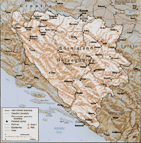
Bosnia-Herzegovina (B-H) sits in the very center of the former Yugoslavia and is geographically bordered by the former Yugoslav republics of Croatia, Serbia, and Montenegro. Physically, the country is largely cut off from the sea by the Dinaric Alps and Croatia. B-H has a tiny piece of coastline at Neum. B-H is very mountainous, with most of the land standing between 800 and 2,000 meters. It only descends in the extreme north along the border with Croatia in the Sava River valley. Rural areas are heavily wooded and dissected by numerous rivers. Narrow tracks, cut into the sides of steep valleys, make movement very difficult. The land area of B-H is 51,129 square km. Of this, about 30 percent is arable, 10 percent is pasture land, and about 46 percent is forest.
The Sava river forms the northern border with Croatia with all the rivers of northern B-H draining into it. The Una, Vrbas, Bosna, and Drina are the major rivers that drain into the Sava. The Drina is the eastern most of these rivers, and it forms the border with Serbia. The Neretva, which rises above Konjic, to the southeast of Sarajevo, is the only major river that flows to the south. It drains into the Adriatic Sea at the important port of Ploce. Bosnia has a small outlet to the Adriatic Sea at Neum. This coastline is 20 km long.
 Back
to Chapter 1: Table of Contents
Back
to Chapter 1: Table of Contents Climate
|
NEWSLETTER
|
| Join the GlobalSecurity.org mailing list |
|
|
|