

The massive requirements for global map data, combined with the desire to have as current information as possible, lead to initial and significant shortfalls in up-to-date ground information for deploying Army forces. The entire Defense and Army mapping communities developed a number of innovative approaches to quickly and accurately describe the terrain over which the battles of the Gulf War were to be fought. One significant means of providing responsive and current geographic information was through the use of multispectral imagery from space systems.
Satellites:
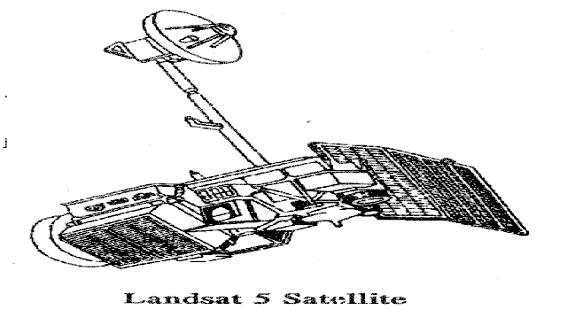
Landsat: The US Department of Commerce operates the Landsat earth resources satellite system. Each satellite can view every part of the earth every 16 days providing imagery of the surface in seven different bands of the spectrum (multispectral) at 30-meter spatial resolution. (For more detail on multispectral imagery, see Appendix C.) The width of one pass is 185 km providing a fairly wide field of view. Landsat imagery can be used to create map products down to about 1:80,000 scale. Imagery from Landsat must be purchased by users and cannot be shared indiscriminately due to copyright concerns. During Operations DESERT SHIELD and DESERT STORM, two Landsat satellites, Landsat 4 and Landsat 5, were operating.
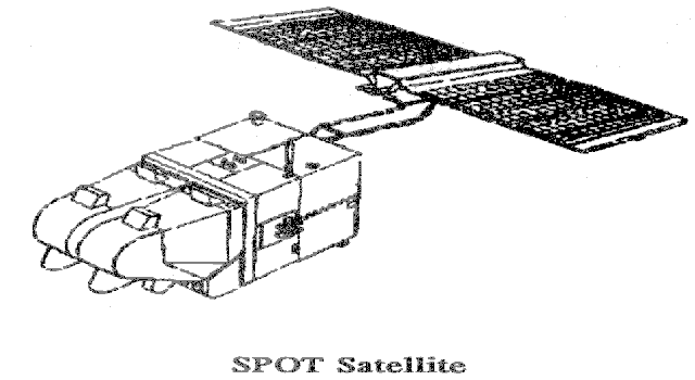
SPOT is a French earth resources satellite that performs much the same mission as the Landsat system. The primary sensor on the SPOT satellite has three different bands at 20-meter resolution and a 10-meter resolution panchromatic band. The 10-meter band permits production of image maps to a scale of approximately 1:25,000. This satellite can view every part of the earth every 26 days. The width of one pass of the SPOT satellite is nominally 60 kilometers. Imagery from the SPOT system under normal conditions is also available commercially and also cannot be shared. (Iraq was not sold any imagery during the August 1990-March 1991 time period.)
Ground Systems:
Multispectral Imagery (MSI) Workstations: Beginning in early August 1990, three multispectral imagery workstations were supporting Army forces at the topographic battalion. These workstations had been part of an Army Space Demonstration Program designed to show users the value of multispectral imagery for producing image maps, conducting terrain analyses, and providing up-to-date broad area views of the battlefield. The workstations generally consisted of high-speed desktop computers operating commercial software called ERDAS (Earth Resources Data Analysis System). This software performed a wide range of image analysis, image enhancement, data merging, and terrain visualization tasks. At the request of the ARCENT topographic engineer battalion, two additional high-speed computer workstations operating ERDAS software were procured to augment the workstations already in place. These systems became operational in November 1990 and provided more and faster processing power.
FORSCOM Automated Intelligence Support System (FAISS): FORSCOM developed a PC-type workstation called the FAISS (pronounced ``face'') to use as an intelligence analyst workstation. They developed a variant of the FAISS that could provide the division terrain teams the ability to automate terrain analysis functions. The FAISS terrain team systems were delivered to Saudi Arabia in December 1990 and to divisions in January 1991. The FAISSs processed MSI data using Terrabase/MS Imager software developed by the United States Military Academy's Geography Laboratory. This software provides a similar but more limited capability than ERDAS. Its strength lies in the fact that terrain analysts had trained with the software before. Eight FAISSs were distributed to division and corps terrain teams. Landsat imagery was provided to these teams in the form of digital audio tapes. This imagery had been preprocessed by a number of organizations prior to final delivery to the terrain teams. Multispectral image capabilities were not available to all units that were supported by organic terrain teams.
OBSERVATION: At the outset of the Iraqi invasion of Kuwait there was an immediate shortfall of both updated standard map products and imagery from the earth resources satellites at the tactical level.
DISCUSSION: Map products of the area provided good coverage but, in some cases, were quite dated, particularly in areas inland of the Persian Gulf. Landsat imagery (1987) procured for a training exercise provided the imagery used by topographic units in preparing map substitutes and terrain analysis products for deploying units. Recent Landsat imagery was also not readily available to the topographic units. Aggressive response to the shortfall was hampered by a cumbersome image procurement process. This process effectively left the topographic units without up-to-date imagery until mid-November 1990. Once the process was refined and organizational responsibilities were sorted out, Landsat imagery was delivered to all Army users. Delivery of imagery to the deployed topographic battalion was accomplished by courier. The courier arrived in theater in mid-January 1990, and imagery was delivered to the terrain and topographic users soon after. This late delivery, coupled with late delivery of the FAISSs, left some divisions with little or no time to exploit the capabilities available.
The Air Force purchased large amounts of SPOT imagery in September and offered the SPOT data to the Army provided the Army could pay the royalties for access to the imagery. The imagery could not be shared with the Army without the payment of additional funds to the SPOT Corporation. The Army requestors did not have dedicated funds to purchase the rights to this imagery. The funding for this imagery was not provided, and SPOT data was not delivered to the requesting topographic battalion.
LESSON(S): Topographic units need to have satellite imagery of contingency areas on hand for quick-response product development.
This basic load of contingency imagery should be updated periodically, and the basic load list should be kept on hand at the distribution points above the users so the imagery can be procured and processed quickly.
An electronic communications means should be considered for delivery of nonintelligence tactical imagery products. This communications capability should extend from CONUS processing facilities all the way to terrain teams at divisions.
OBSERVATION: Acquisition of usable satellite imagery (properly rectified and in a hardware format (floppy disks, tapes, compact disks, etc.) readable by the supporting hardware and software) took over three months from the outset of Operation DESERT SHIELD.
DISCUSSION: As discussed in the previous lesson and the system overview, there were delays in delivery of usable satellite imagery to the supporting topographic units. Part of this problem resulted from the array of different systems being used to produce such imagery. Getting updated imagery into formats readable by all of these machines required the concerted efforts of a number of organizations. Even with this massive outpouring of support, it wasn't until mid-November 1990 that post-invasion Landsat imagery was made available to tactical units. French SPOT data never did arrive in the quantities requested by the users prior to the start of the ground war.
LESSON(S): Procedures for the procurement of MSI data must include consideration of the different types of systems that will be processing the data.
Contingency plans should include the clear assignment of data dubbing (transferring data from one type of hardware format to another) responsibility to a specific organization.
These procedures must be exercised during training events.
OBSERVATION: The standard production procedures used in topographic units had to be altered to accommodate the imagery processing requirements.
DISCUSSION: Production of map products is a complex process requiring aggressive quality control to ensure that the maps sent to the users are accurate. The addition of MSI data to the processing added an additional layer of quality control not part of the normal procedures. This was a new capability provided by commercial off-the-shelf equipment. Soldiers were learning as they produced the first image-based products.
The soldiers in the topographic units had to be trained in new procedures and quality checks to review the imagery as it progressed from receipt at the unit to printing of the final product. This training/production/quality issue was further complicated by the urgency of the requests for products.
LESSON(S): Topographic units need to review their production procedures where they apply to image map production. These procedures must include the hand-off of imagery from one organization (external or internal) to the next.
Topographic engineer soldiers must be equipped and trained to produce image-based products.
OBSERVATION: The commercial off-the-shelf computer workstation added an extremely powerful data-merging capability for the topographic units.
DISCUSSION: Data from Landsat, SPOT, and other intelligence sources were merged using the computer workstation. These products incorporated the broad area detail of Landsat, further enhanced with the detail of higher resolution imagery and intelligence information. Patterns of enemy activity and militarily significant terrain modifications became more obvious after data fusion. Intelligence information was sent via electronic mail to theater and handcarried via floppy disk to the topographic units for incorporation into image map products. Weather imagery received by ARCENT's DMSP receiver could be displayed and enhanced using the workstation.
LESSON(S): The commercial hardware and software used to support MSI production was flexible enough to allow exploitation of other data.
Document the interaction between the stateside intelligence analysts and the deployed topographic units to enhance future operations.
Commanders and staffs need to be shown current capabilities for merging data sources and the value that this could provide to their units. This will help them know what they should expect to get from their terrain and intelligence staffs in the form of enhanced map products.
OBSERVATION: The organizational structure of the topographic companies and battalions could accommodate exploitation of imagery, but on-hand TO& equipment could not.
DISCUSSION: The mission of the existing photomapping and terrain analysis platoons includes the use of photographs for the production of photo maps and performing terrain analysis. The equipment available and the training received by the soldiers of these platoons prior to the beginning of Operation DESERT SHIELD were not adequate for full exploitation of multispectral imagery. The existing Topographic Support System (TSS) that permits development of photo maps from 9 inch x 9 inch aerial photographs could not be used with digital satellite imagery.
Exploitation of MSI and other digital imagery was made possible by acquisition of commercial image processing equipment.
To accelerate the incorporation of digital imagery into the topographic battalion, a team was organized from the assets of the existing topographic units to use the new workstations. The team represented both cartographic and terrain analysis skills. The small number of personnel involved and the competing requirements of deployment preparation and normal unit duties and functions caused some problems in maintaining continuity of the image mapping mission early in the operation.
LESSON(S): Commercial equipment and software procured for Operations DESERT SHIELD and DESERT STORM expanded the capabilities of topographic units.
The TSS must be updated with equipment that will exploit available types of imagery, i.e., replace the old hardcopy photo equipment with digital equipment.
Topographic soldiers require training in satellite imagery exploitation.
OBSERVATION: There are currently no standards for producing MSI products.
DISCUSSION: MSI data provides an almost infinite number of possible combinations and display possibilities. The state of the art in MSI processing relies heavily on user experience and creative application. Exploitation of MSI data for Operation DESERT STORM was very much a learning experience for the topographic units. This learning experience occupied time that was not spent in delivering products to the user.
LESSON(S): Standard products and procedures should be considered for rapid and consistent application of MSI data. A blend of standard capabilities and flexible applications must be available to the MSI specialist.
The topographic engineer soldiers producing the image maps need to be trained to exploit the imagery available to them.
Training on image map use must be conducted in all basic leadership courses.
OBSERVATION: A hardcopy capability gap exists between being able to produce a small number of image maps quickly and a large number within a day.
DISCUSSION: MSI adds a tremendous capability to the terrain analyst working at a computer workstation with a high resolution color monitor. Providing this high-quality image to a tactical user in the time and quantity required was not always satisfactory. A universal complaint from the tactical user was that the imagery received was very good, but there was not enough. During Operation DESERT STORM, topographic units could produce a relatively small number of high-quality black and white hardcopy products within an hour, and they could produce large quantities within a day. Missing in this range of capabilities was the ability to produce 10-200 copies within an hour or two for quick distribution. This resulted in units being starved of the latest terrain/topographic products. The topographic units could produce color copies on existing presses. The process takes eight hours to produce the first copy.
LESSON(S): Topographic units need a large format color printer to produce hardcopy products at a rate of 10-200 per hour. Division-level units expressed a desire for this capability as well.
Topographic units need a hard-copy output device able to produce color output quickly. This device should be able to receive digital data directly from the image processing system.
| "We
were moving so fast that we literally ran off our map sheets." 2d Armored Division (Fwd) |
 Table
of Contents
Table
of Contents
 Chapter
2: The Battlefield Environment, Part 1
Chapter
2: The Battlefield Environment, Part 1
 Chapter
3: Tactical Missile Early Warning
Chapter
3: Tactical Missile Early Warning
|
NEWSLETTER
|
| Join the GlobalSecurity.org mailing list |
|
|
|