| It’s 0200, and Texas
(SSN-775) creeps closer to the departure point for her SEAL team, only a few miles south
of the principal seaport of a hostile nation. It’s shallow, and the seas are up, but
the SEALs need to be brought close enough to complete their mission before dawn. After the
Swimmer Delivery Vehicle is away, Texas will be monitoring enemy comm circuits for any
sign that the operation has been compromised, as well as gathering information on the
order of battle ashore. There’s not a lot of margin for uncertainty. To avoid
unpleasant surprises, the Texas crew needs to know about water depth, local current and
salinity patterns, and acoustic conditions that might hide a slow, quiet KILO. The SEALs
have their own questions: What’s the water temperature and sea state tonight? When
and where are the currents running that will help or hinder our egress? How much water
will there be over that last sand bar between us and the objective? How about clouds and
moonrise? For this mission, weather and ocean conditions are the key to success – or
failure… |
As the U.S. Submarine Force scales back, the
Navy expects a lot more from each individual boat, and gaining a tactical edge over
potential adversaries by exploiting the ocean and weather environment becomes increasingly
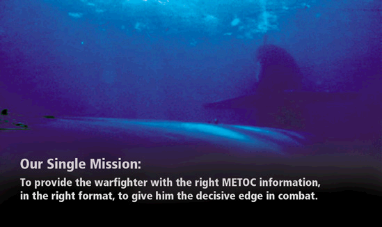
im-portant. Interpreting the battlespace environment for our warfighters is the primary
function of the Naval Ocean-ography community, which provides a wide range of specialized
support to tactical and strategic submarine missions, such as anti-submarine warfare
(ASW), land attack, special forces operations, and the whole gamut of intelligence,
surveillance, and reconnaissance (ISR). Many of our products feed directly into tactical
decision aids hosted in the Submarine Fleet Mission Program Library (SFMPL). We’re
part of your team.
With our renewed emphasis on littoral warfare and the projection of power
ashore, U.S. submarines are increasingly finding themselves in shallow-water coastal
regions, hard against hostile shores, and facing air-ocean environments far more complex
and threatening than any they saw during the typical “blue water” operations of
the Cold War. Deep ocean phenomena evolve over large time and spatial scales – days,
weeks, and hundreds of kilometers. Coastal features change a lot more rapidly in time and
space – over minutes, hours, and a few hundreds of meters. And there are a lot more
phenomena to contend with: shore and bottom features, coastal shipping noise, radar
ducting, tides and currents, fresh-water run-off, marine meteorology, and a host of
others. On top of that, we will be operating in an adversary’s backyard and need to
know as much about his own turf as he does, or more.
To help the warfighters face these challenges, Navy oceanographers are
bringing to bear every available resource to understand, predict, and portray the natural
environment of waves, water, and weather. We are introducing new technologies for rapid,
remote, and autonomous data collection, especially in denied areas. We are testing rapid
techniques for assimilating this data and increasing the fidelity of historical databases.
We are developing new models tuned to the complexity of coastal environments. We already
use the Navy’s two largest super-computers in our weather and ocean modeling centers
ashore, and we are upgrading their capacity. Most importantly, we are learning to produce
user-friendly products tailored specifically for day-to-day operations and shortening our
turn-around time in delivering them to our commanders and decision-makers.
Whether we’re providing real-time environmental support or creating
longer-lived products like acoustic data bases, nautical almanacs, and charts, we follow a
common three-step process: gathering needed environmental data; processing it to
understand or predict underlying natural phenomena; and providing tactically significant
findings to the ultimate users when, where, and in the form they want.
Varied Data Sources
A traditional source of oceanographic data is our small fleet of military survey ships
operated by the Military Sealift Command for the Naval Oceanographic Office (NAVOCEANO).
These T-AGS-class ships are deployed overseas almost continually and spend nearly 300 days
at sea each year, collecting multi-mission data worldwide and participating frequently in
Fleet exercises. However, in situ measurements made on deployed combatants, such as by the
new multibeam sonars going on 688 submarines, are our best source of local data and fill
in many of the gaps. Much of our information about foreign coastal waters derives from
international data exchange and cooperative agreements under which host nations share
their own ocean data in return for our technical guidance and equipment support.
Increasingly, however, “non-traditional” collection techniques are taking a
larger part as new technical developments appear. Recently, these have included drifting
buoys for reporting both surface and acoustic conditions, miniaturized, parachute-borne
instrument packages launched from tactical aircraft chaff dispensers for measuring
atmospheric parameters, and airborne laser systems for “quick and dirty”
shallow-water bathymetry surveys.
The growing availability of remotely sensed data from earth-observing
satellites is revolutionizing many aspects of tactical meteorology and oceanography, a
discipline we abbreviate as “METOC.” The vantage point of space provides not
only large synoptic views of broad-area phenomena and high-resolution imagery portraying
littoral features of significant military interest, but also uncontested access to denied
areas. Using combinations of data from space-based visual, infrared, and radar sensors,
even subtle details about sea surface temperature, current rips, and bathymetry can be
discerned.
Process and People
With oversight by the Commander, Naval Meteorology and Oceanography Command (CNMOC), the
worldwide presence of the Naval Oceanography community takes many forms. Most
prominent ashore are NAVOCEANO at Stennis Space Center, Mississippi, and the Fleet
Numerical Meteorology and Oceanography Center, Monterey, California. Together, they are
responsible for assimilating air-ocean data from all sources and running numerical
prediction models at both global and local scales, as well as disseminating and archiving
the results. Directly serving major Fleet operating areas are regional METOC centers at
Norfolk, San Diego, Pearl Harbor, Rota (Spain), and Yokosuka (Japan). These merge output
from the two large shore processing facilities with timely local information, and by
operating 24-hour watch floors, provide continuous, tailored weather and ocean support to
staffs and ships in their areas of responsibility. Additionally, Mobile Environmental
(MET) Teams deploy from the centers on a quick-reaction basis in response to Fleet tasking
for local and unit-level support. Aircraft carriers and major, air-capable amphibs have
METOC divisions aboard to support air, ASW, and amphibious operations, and smaller
detachments
are found at most Navy and Marine Corps air stations and at key Fleet operating
bases. We also have a senior METOC officer assigned to each major Fleet and CINC staff,
both ashore and afloat, as the key advisor for tactical oceanography.
Products to the Warfighters
In our increasingly network-centric navy, the METOC community is actively developing new
ways to “get connected” to the warfighters they serve. In the hypothetical
Special Forces and ISR scenario described above, for example, Texas would have been
provided detailed environmental information on her specific objective area prior to
arrival, but the Global Command and Control System (GCCS) and the Global Broadcast System
(GBS) would send near real-time updates to the submarine over satellite communication
channels. Additionally, direct downlink of environmental data from remote sensing
satellites to warfighters will become increasingly common in the 21st century. On board,
these data will be entered directly into standard prediction models or tactical decision
aids, which in several systems generate three-dimensional “visualizations” of
METOC conditions or red/yellow/green “stoplight” charts that portray
environmental factors affecting GO/NO-GO decisions.
The Warfighting Support Center (WSC) at NAVOCEANO was established
specifically to provide quick reaction METOC support to both real- world and exercise
operations. Staffed with both military and civilian oceanographers and intelligence
analysts, it has electronic access to the most comprehensive and sensitive environmental
intelligence that can be derived from both unclassified and classified sources. For the
notional SEAL team on Texas, the WSC would produce a tailored Special Tactical
Oceanographic Informa-tion Chart (STOIC), showing the location and character of local
seafloor features, temperature, tides, currents, sand bars, and pollution and biologic
hazards, often superimposed on a large scale satellite photograph of the area of interest.
Similarly, the Submarine Force and other battlegroup assets can call on the WSC to provide
detailed METOC products with the latest information on relevant acoustic conditions,
landing areas, and ISR objectives.
 |
Naval Oceanography
and the SSBNs
In addition to supporting tactical operations, Naval Oceanography
makes important contributions to the ballistic missile submarine element of the
Nation’s strategic deterrent. For over three decades, NAVOCEANO has carried out a
world-wide program of gravity and bathymetry surveys at sea. The bathymetry data support
precise, at-depth positioning, and local gravity gradients are an important pre-launch
input to strategic missile guidance systems for improving their terminal accuracy.
The U.S. Naval Observatory (NAVOBSY), also under the
Oceano-grapher’s purview, maintains the Nation’s Master Clock – the
ultimate standard for precise time – that supports precision navigation, targeting,
and secure communications. More-over, NAVOBSY’s astrometry program provides precise
star positions used for strategic missile guidance corrections outside the earth’s
atmosphere. |
New Directions for Tailored METOC
Support
The Naval Oceanography community is also expanding our capabilities in a number of other
areas to serve the Submarine Force as it integrates into the battlegroup and reorients
itself for littoral operations:
- ELINT and Electro-Optical Collection.
Atmospheric temperature, pressure, humidity, and aerosol properties greatly affect radar,
radio, and optical propagation. The effectiveness of submarine ISR missions thus depends
on a knowledge of these conditions. The Fiscal Year 1999 build of NITES II – the Navy
Integrated Tactical Environmental System – will include integrated software for
on-board analysis of these effects.
- Submarine-Launched Mobile Mines (SLMM).
Because of their relatively slow speed, SLMMs are especially subject to set and drift from
ocean currents at depth. In the near future, improved predictions of set and drift from
satellite and buoy observations will be entered into the SFMPL’s SLMM Tactical
Overlay.
- Shallow Water ASW.
Optimizing the use of submarine sonar in shallow water requires a wide range of METOC
inputs, and for littoral operations, high levels of detail and resolution are needed for
SFMPL tactical decision aids. We are also working on future additions for handling
magnetics, bioluminescence, and other non-acoustic phenomena.

Near-shore water depths measured by an airborne laser
bathymetry system in NATO exercise Rapid Response.
- Ice Cover.
NAVOCEANO’s Naval Ice Center generates analyses and predictions of sea-ice and Arctic
pack ice – including ice edge location, concentration, movement, and thickness –
to assist submarines in under-ice navigation, and in particular, for identifying areas
where surfacing is possible.
- Bathymetry and Digital Nautical Charts.
High-resolution bathymetric surveys are being extended to cover littoral areas of interest
for SSN missions, particularly in potential Major Regional Conflict areas and in the
Philippine and South China Seas.
In addition to these and other efforts within the Naval
Oceanography community, OPNAV’s Director of Submarine Warfare (N87) is developing new
capabilities for precision bottom-mapping and “in-stride” environmental data
collection by SSNs themselves. These advances will make attack submarines even more the
platforms of choice for covert, non-provocative “preparation of the battlespace”
in denied areas.
A Word about the Naval Oceanography Community
The Navy METOC community is headed up by the Oceanographer of the Navy on the Staff of the
Chief of Naval Operations. The Oceanographer is always an Unrestricted Line
“warfighter” to better represent the METOC “customer,” and two of the
last four incumbents have been senior submariners. Our community consists of 1,500
civilians, 1,300 enlisted Sailors – mostly Aerographer’s Mates – and 350
METOC officers in the “1800” series. Virtually all of the latter have dual
Master’s degrees in meteorology and oceanography.
On a worldwide basis … from the bottom of the ocean to the edge of space
… we’re here to serve.
|