

APPENDIX K
MAPS AND CONTROL MEASURES
This appendix presents some military symbols and control measures which are of operational interest to the ADA platoon. BSFV platoon personnel must know how to use a map. Each squad leader should have a plastic map case and marker to post operational symbols. Because the loss of key personnel may result in the platoon sergeant or squad leader assuming control of the platoon, the platoon sergeant and each squad leader must know his location at all times and have the platoon's operational graphics properly posted on his map.
Performing land navigation while mounted at high speeds is now easier with the global positioning system (GPS) locator. However, all key leaders must still be able to use terrain association. Making a thorough map study and identifying major terrain features, contour changes, and man-made structures that exist along a route is essential. As the platoon advances, the platoon leader and squad leaders must observe existing features and elevation change. They use these and structures on the ground to orient or locate themselves and other elements of the platoon. For a complete list see of military symbols and control measures, see FM 101-5-1.
COLOR REPRESENTATION
Ideally, different colors are used for enemy and friendly symbols. Different colors may not always be available; therefore, other procedures are needed for one-color symbols as well as for multicolor representation.
ONE COLOR REPRESENTATION
Friendly symbols are outlined by a single line, and enemy symbols are outlined by double lines. For enemy equipment, ground environment, and activities symbols, use the abbreviation EN.
MULTICOLOR REPRESENTATION
The colors on a military map indicate varied meanings. These meanings are given below:
- Blue or black indicates friendly units, posts and installations, equipment, activities, and ground environment symbols not covered by other colors.
- Red indicates enemy units, posts and installations, equipment and activities, and friendly fire support ground environment symbols not covered by other colors.
- Yellow indicates friendly and enemy chemical or radiological areas and enemy biological areas.
- Green indicates friendly and enemy manmade obstacles.
- Other colors used must be explained in a legend.
CONTENTS
When overlays are transmitted by facsimile, only black on white is possible. To differentiate between enemy and friendly contaminated areas or obstacles, use the abbreviation EN in the line that defines the enemy area.
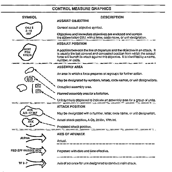
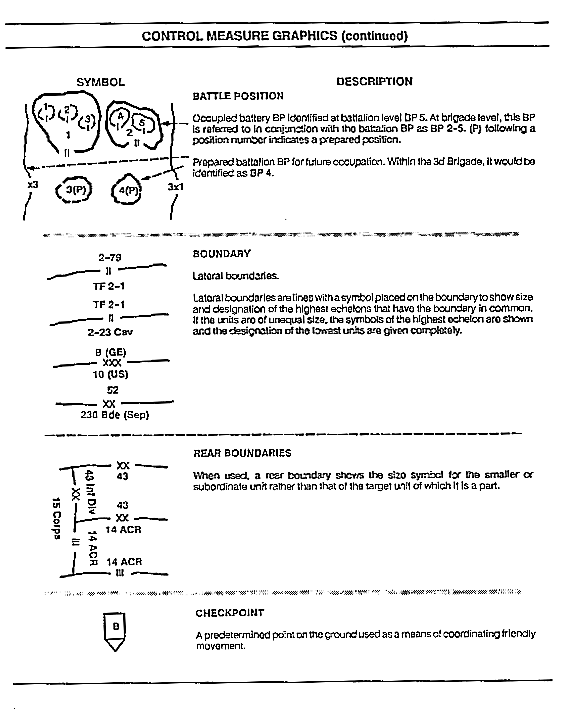
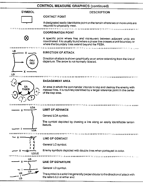
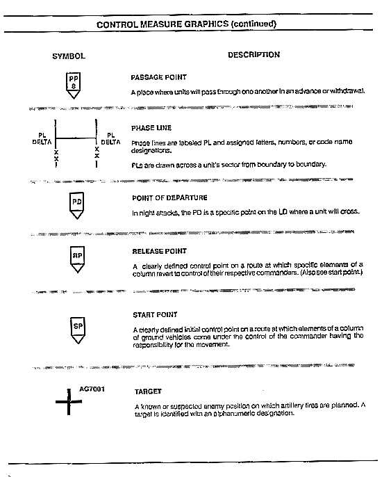
CONTROL MEASURES
Most of the control measures commonly used by the battery or supported commander are also used at the platoon level. See the Control Measure Graphics illustration to help facilitate the use of this manual.
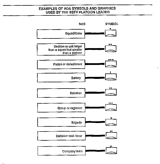
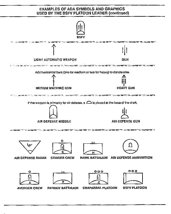
ADA SYMBOLS AND GRAPHICS
Symbols and graphics represent units of varying sizes and operations, equipment, activities, or other items of military interest. In order to properly plan and interpret operational graphics, the BSFV platoon leader must know the ADA symbols and graphics. See the following illustration.
|
NEWSLETTER
|
| Join the GlobalSecurity.org mailing list |
|
|
|