
New Orleans, LA
Surekote Levee
Post-Hurricane Katrina
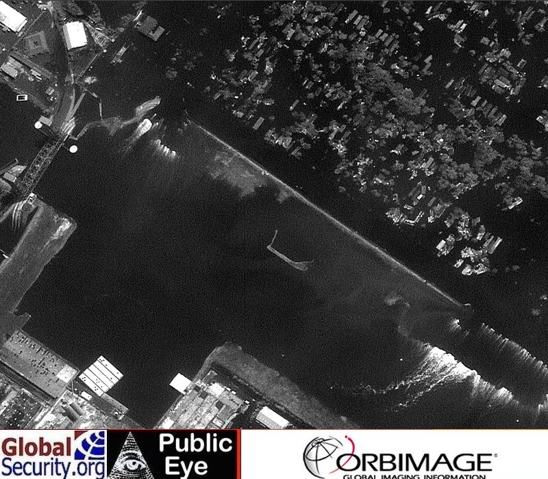
The imagery below is of the Surekote Levee in New Orleans post-Hurricane Katrina. Both images depict the Surekote levee and were taken on August 31, 2005. They were, however, taken by two different satellites. The first image was taken by the ORBIAMGE OrbView-3 satellite while the second image was taken by the DigitalGlobe Quickbird satellite.
Clearly visible in both images is the breach in the levee and the water flowing. It is important to note, however, that in contrast to the 17th Street levee breach, in which the water is flowing into the city, in this case the water is flowing out of the city. That is, water had overtopped the levee and filled the basin created by the encircling levee. Subsequently, as the water level subsided below the top of the levee, a breech formed which permitted further drainage.
| Comparative Landsat satellite imagery of the Surekotee Levee in New Orleans post-Hurricane Katrina | |
| Toggle mouse over and off image for comparison | |
|
|
 Post-Hurricane Katrina comparative satellite imagery of the Surekotee Levee in New Orleans
 |
|
NEWSLETTER
|
| Join the GlobalSecurity.org mailing list |
|
|
|