

Ahmed Al Jaber Air Base
28°56'05"N 47°47'31"E
| Imagery of Ahmed Al Jaber Air Base |
|
 For more Public Eye satellite imagery, see the Picture of the Week Gallery of satellite and other imagery of places in the news. | |
| Click on the small image to view a larger version | |
 Overview of the Middle East with Kuwait in the center |
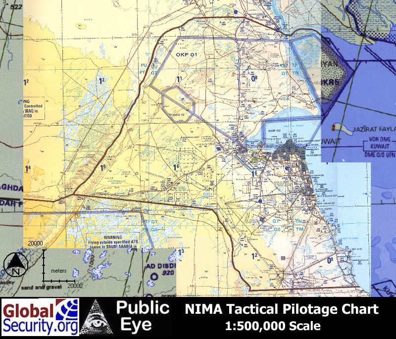 Tactical Pilotage Chart of Kuwait |
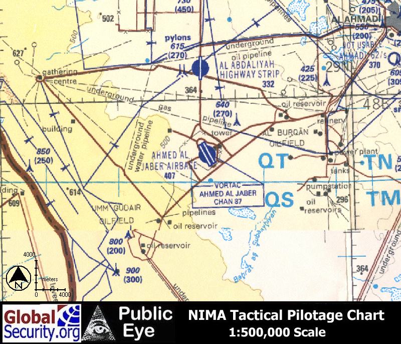 Tactical Pilotage Chart of Ahmed Al Jaber Air Base |
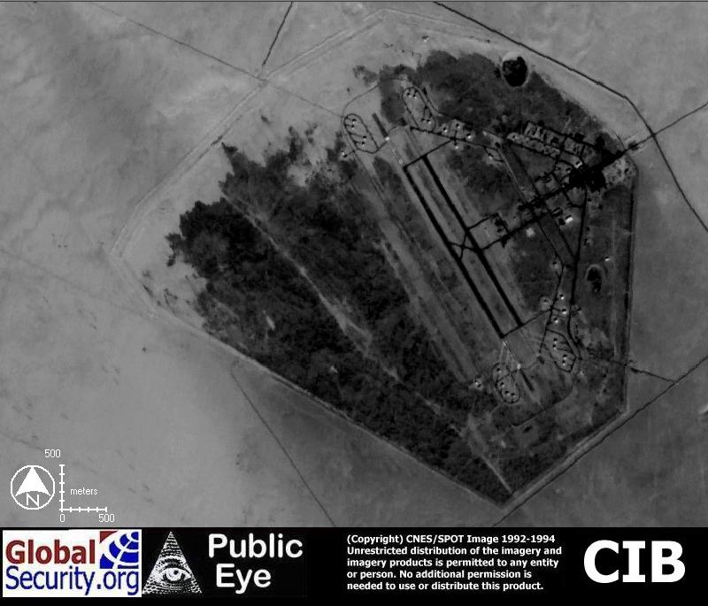
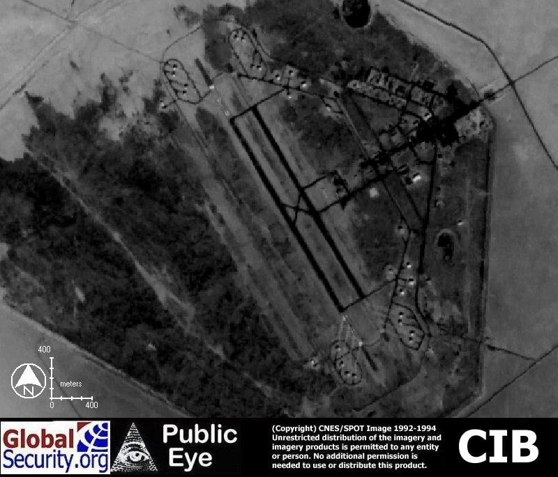
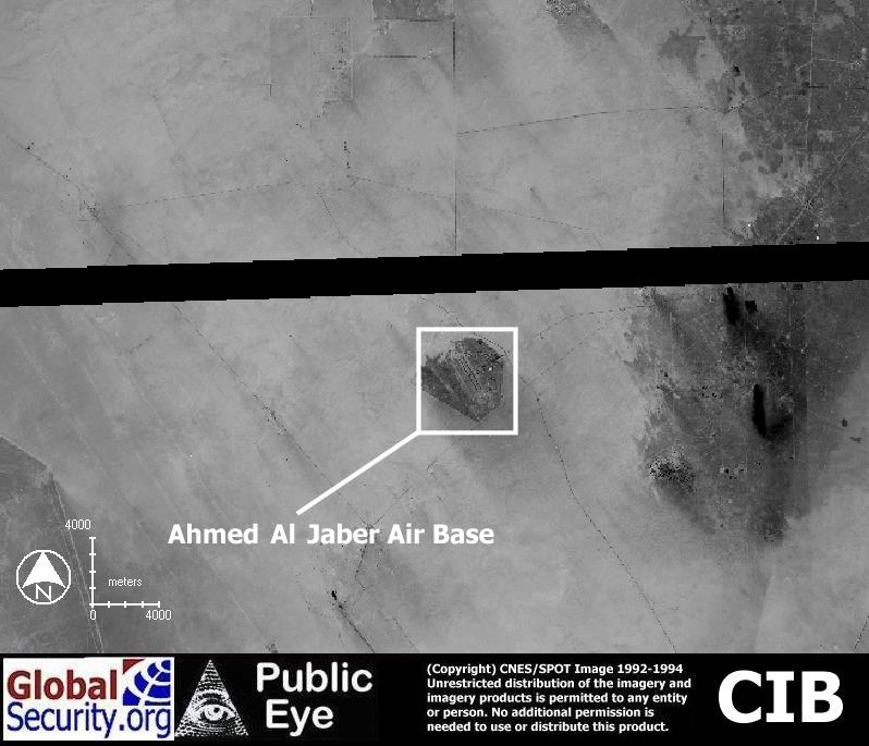 NIMA 10 meter Controlled Image Base (CIB) imagery of Ahmed Al Jaber Air Base as of 1995 |
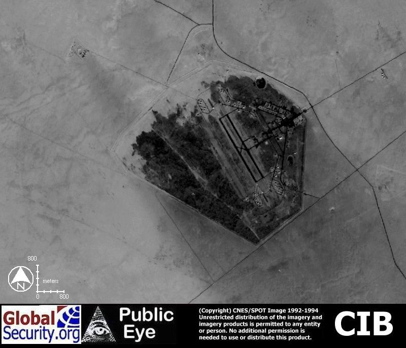 NIMA CIB imagery showing the Ahmed Al Jaber Air Base |
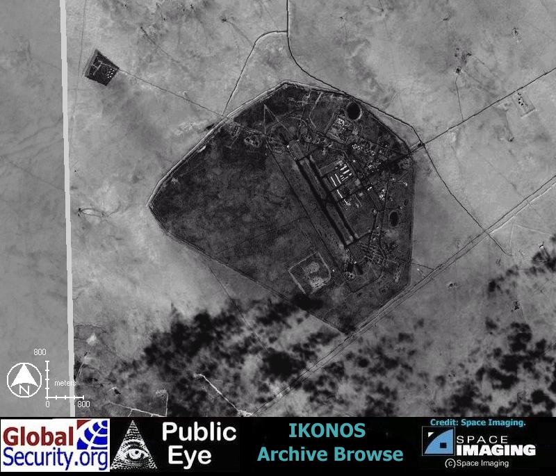 IKONOS Browse imagery showing Ahmed Al Jaber Air Base as of January 20, 2000 |
 Ahmed Al Jaber Air Base is protected by a 17 kilometer security perimeter. The base occupies over 5,100 acres. |
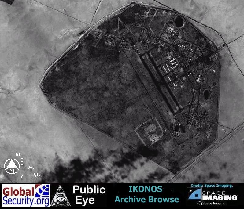 IKONOS Browse imagery showing Ahmed Al Jaber Air Base |
 Ahmed Al Jaber Air Baseis supported by two 9,800 foot runways. |
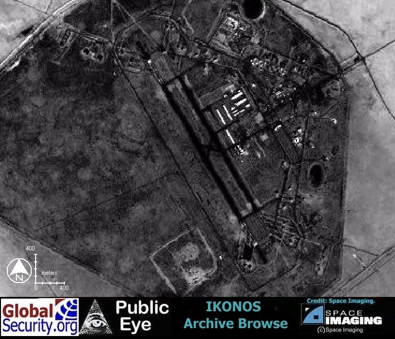 IKONOS Browse imagery shows no apparent change in runway length as of January 20, 2000 |
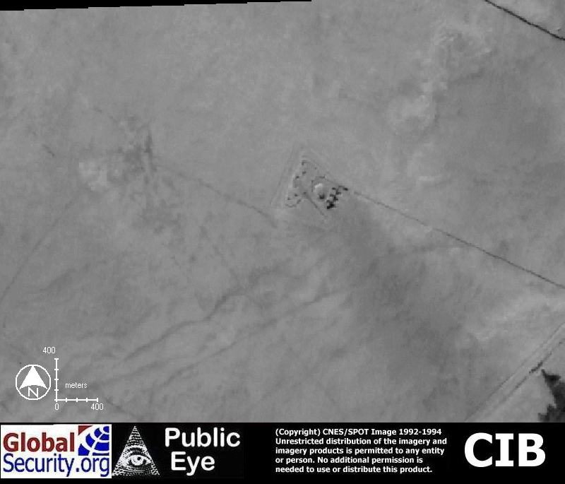 NIMA CIB imagery showing a possible weapons storage area 5 kilometers Northwest of the Ahmed Al Jaber Air Base |
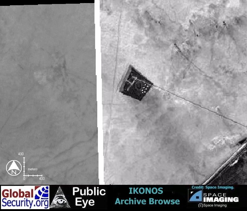 IKONOS Browse imagery showing a possible weapons storage area 5 kilometers Northwest of the Ahmed Al Jaber Air Base |
|
NEWSLETTER
|
| Join the GlobalSecurity.org mailing list |
|
|
|