

Joint Service Imagery Processing System [JSIPS]
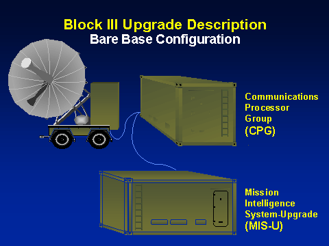
 JSIPS is a joint USAF, US Navy (USN), and US Marine Corp (USMC) program to develop a common ground station capable of receiving, processing, exploiting, and disseminating imagery intelligence products collected by national, theater, and selected tactical reconnaissance assets. Modifications to JSIPS are driven by changes in the national imagery community. In order to realize the increased capability from national systems (e.g., higher resolution, greater geolocational accuracy, etc.) upgrades must be made to the JSIPS hardware and software. Thse are required to maintain compatibility with national sensor data. They provide enhanced capabilities (e.g., higher resolution, greater geolocational accuracy).
The USAF will use the system to process national imagery in support of the Air Operations Center. The USMC will use JSIPS to support their national imagery requirements and process/exploit Advanced Tactical Air Reconnaissance Systems (ATARS) imagery via the Tactical Exploitation Group (TEG). The USN will employ a shipboard JSIPS system to support national imagery needs and to process ATARS imagery. JSIPS' ruggedized construction enables it to be installed in 10-foot and/or 20-foot shelters and on-board aircraft carriers for rapid global deployment via air, road, rail, and sea.
Accomplishments
Exceptional Engineering Development Model performance (3 workstations)
- Operated 24 hrs/day, 7 day/week
- Achieved 520 target reports
- 130-140 tasks per day
- Averaging 12 reports per hour
- 25 Secondary images per week (vs. Corps req of 14)
- System Performance assessment conducted March 1994
- All objectives successfully met
Status
- The Marine Corps is currently operating JSIPS at Camp Pendleton, California.
- Two production systems are being fabricated for the USAF:
- 9th Air Force, Shaw AFB, South Carolina, currently undergoing training
- HQ 12th Air Force, Davis-Monthan AFB, Arizona, 1997

This system will migrate to the IESS standard by 1998, and subsequently converge to the ESS configuration by 2001. The Exploitation Support System (ESS) will be the community's common imagery exploitation support system. Both the National Imagery and Mapping Agency (NIMA) Exploitation System (NES) and IESS will migrate to ESS by the end of FY01. Agency Program: The DoD is in the process of establishing a simplified baseline of the best, common information systems across the business functions of the Department. These migration systems represent a stage of process improvement designed at achieving a common set of automated processes and practices in DoD.
Commercial Off-the-Shelf (COTS) Softcopy Exploitation Workstation Upgrades for JSIPS upgrades will take advantage of computational and processing improvements to increase softcopy imagery exploitation capabilities (i.e., multispectral imagery, automatic target cuing/ recognition, video imagery). Major advantages include: Improve interoperability with other DoD imagery exploitation systems; Reduce amount of special purpose hardware and software; Employment flexibility will allow deployments to improved/unimproved facilities.
Commercial Imagery Initiatives provide the Joint Service Imagery Processing System (JSIPS) a deployable commercial imagery receive capability. Provides broad area and multi-spectral imagery to military users. This unclassified imagery will greatly improve the ability of warfighters to acquire imagery for mission planning, battlefield rehersal, and receipt at the unclassified level. Major advantages include: Increases amount/types of imagery available to warfighters; Available for use in mission planning/exercises; Releasable to foreign nationals.
|
NEWSLETTER
|
| Join the GlobalSecurity.org mailing list |
|
|
|