

Bagram Air Base
IKONOS Imagery August 13, 2001
IKONOS imagery as of August 13, 2001, shows 19 MIG-21 aircraft in revettments, and 5 possible MIG-23 aircraft parked on open ramp space. There are about two dozen of abandoned aircraft scattered around the airbase, inclunding an AN-12 CUB an AN-24 COKE and an IL-28 BEAGLE medium bomber.
| Overview Maps of the Bagram Airbase |
||
| Click on the small image to view a larger version |
 For more Public Eye satellite imagery, see the Picture of the Week Gallery of satellite and other imagery of places in the news. |
|
 Overview depicting location of Bagram Airbase |
||
 TPC map of Bagram area |
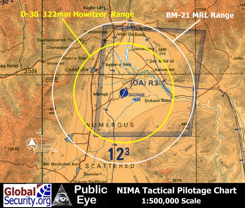 Estimated Range of Talibad BM-21 MRL and D-30 Howitzer coverage of Bagram Airbase |
|
| August 13, 2001 Ikonos Images of Bagram Airfield - Revetments |
||
| Click on the small image to view a larger version | ||
 |
 |
 |
 |
 |
||
 |
 |
|
 |
 |
|
| Ikonos Images of Bagram Airfield - Hangars |
||
| Click on the small image to view a larger version | ||
| |
 |
 |
 |
| Ikonos Images of Bagram Airfield - Vehicles |
||
| Click on the small image to view a larger version | ||
 |
 |
|
| Operation Enduring Freedom |
||

|

|
|

|

|
|
|
NEWSLETTER
|
| Join the GlobalSecurity.org mailing list |
|
|
|