New Orleans
Broken Levee imagery
Satellite imagery showing views of the London Avenue Levee New Orleans, LA, before and after Hurricane Katrina. The imagery was taken by the DigitalGlobe Quickbird satellite on 31 August 2005.
| Satellite imagery showing views of the London Avanue Levee New Orleans, LA, before and after Hurricane Katrina. |
|
|
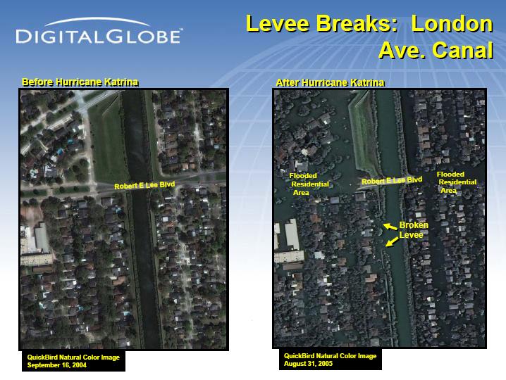 Satellite imagery showing views of the London Avanue Levee New Orleans, LA, before and after Hurricane Katrina.
|
|
NEWSLETTER
|
|
Join the GlobalSecurity.org mailing list
|
|
|
