
2005 Hurricane Rita
GOES-12 Satellite image provided by the U.S. Naval Research Laboratory, Monterey, Calif., showing the status of Hurricane Rita at approximately 8:00 am EST. Rita, a dangerous category three hurricane on the Saffir-Simpson Hurricane scale, had maximum sustained winds near 135 mph with higher gusts. Hurricane force winds extended outward up to 85 miles from the center and tropical storm force winds extended outward up to 205 miles. The eye of Hurricane Rita was located approximately 220 miles Southeast of Galveston, Texas and about 210 miles Southeast of Port Arthur, Texas.
| Overview satellite imagery of Hurricane Rita | |
|
|
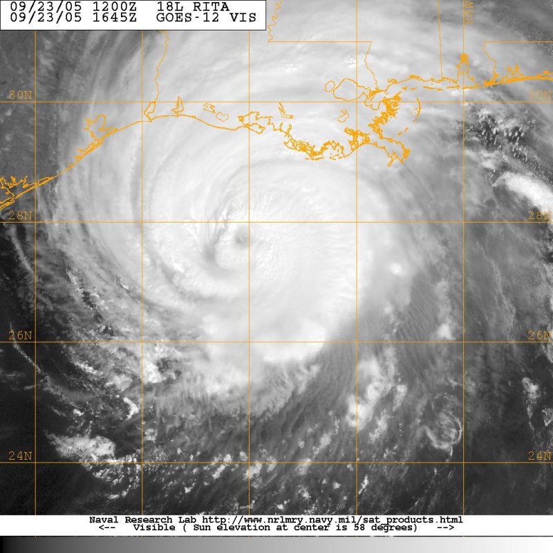 Overview satellite imagery of Hurricane Rita
[Source: U.S. Naval Research Laboratory, Monterey, CA] |
|
NEWSLETTER
|
| Join the GlobalSecurity.org mailing list |
|
|
|