
2005 Hurricane Rita
GOES-12 Satellite infrared image showing the status of Hurricane Rita at approximately 3:30 am EST on Sept. 22, 2005. Rita, was then 490 miles Southeast of Galveston, Texas, was upgraded to a Category 5 storm late Wednesday with 170 mph winds, sparking an order for mandatory evacuations in New Orleans and Galveston, Texas
| Overview satellite imagery of Hurricane Rita | |
|
|
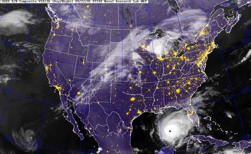 Overview satellite imagery of Hurricane Rita
[Source: U.S. Naval Research Laboratory, Monterey, CA] |
|
NEWSLETTER
|
| Join the GlobalSecurity.org mailing list |
|
|
|